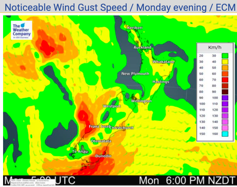
Monday’s national forecast – High pressure covers NI, cool in Canterbury/Coastal Otago (+10 Maps)
20/12/2020 3:00pm

> From the WeatherWatch archives
Today is the summer solstice (the longest day of the year, or day with the most amount of available sunlight). The precise time of the solstice is 11:02pm. Being so close to midnight, it means tomorrow will basically be equal length to today too
Dry weather continues over northern NZ while rain continues on the West Coast and into some eastern areas of the South Island.
The South Island’s eastern side, mainly Canterbury and coastal Otago, are colder than average today – while much of the rest of NZ leans warmer.
The upper North Island is dry again today while the southern half of the island may see a few showers.
Yasa’s remnants are moving towards northern NZ, as modelling has indicated for two weeks now. But – High pressure in the NZ area is dominating and as we said last week, was likely to tear Yasa apart. The rainy remnants will likely trigger just east of NZ. While this may be great news for many not wanting a wet Christmas (or build up to it) this rain event would’ve been very timely for farmers, growers and Auckland’s water storage dams.
In fact, Yasa’s remnants not arriving in NZ may even signal a more serious problem ahead if rain doesn’t return to the already drier than average upper North Island.
We’ll have more details about this developing dry pattern in our weather video out this morning.
Also today – and in our video too – we’ll have more details on top of the hourly local forecasts for Christmas Day. It may not be settled and perfect for everyone!


Comments
Before you add a new comment, take note this story was published on 20 Dec 2020.


Add new comment