Make the most of sunny, calm weather – the first wintry outbreak looks likely next weekend (+3 Maps)
1/04/2020 8:04pm

> From the WeatherWatch archives
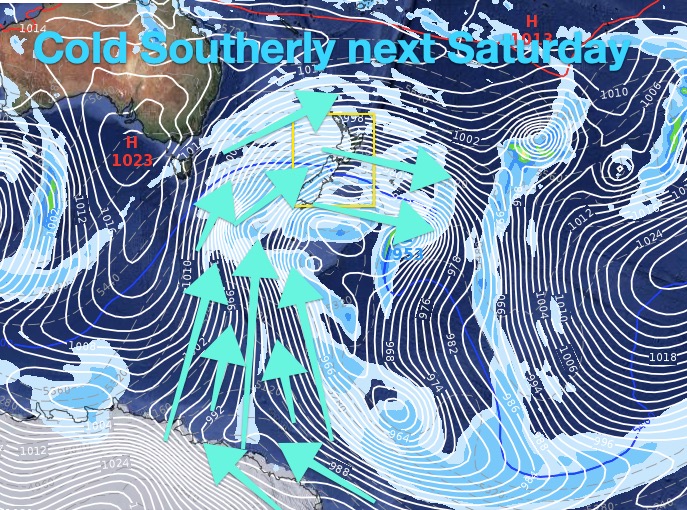
The next several days ahead will be warmer than average in a number of regions, but it won’t last. Autumn is all about ups and downs and computer modelling is increasingly locking in a major storm south of New Zealand in just over a week, which will likely bring the first ‘winter outbreak’ for 2020 into the country.
While it’s too far out to lock in specific details like snow levels and those most impacted the likely scenario is a very deep low pressure system in the Southern Ocean with central air pressure potentially getting down to 940hPa halfway between Antarctica and Southland. This would see much of New Zealand caught up in the windy zone, with a possible southerly off the icecaps next weekend in some regions.
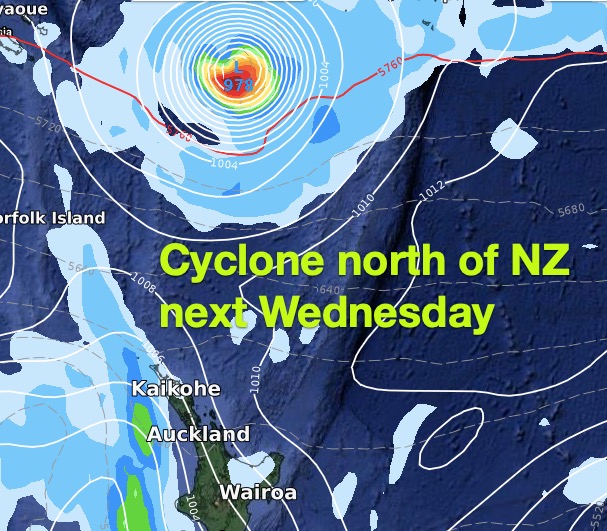
April is an interesting month with still a taste of summer but strong hints that winter is coming. A tropical cyclone will next week track into the NZ area but remain offshore. Hours later we’ll be focused on another storm in the Southern Ocean.
Otago and Southland which have highs into the low 20s this weekend, will likely have highs in the single digits next weekend in exposed areas.
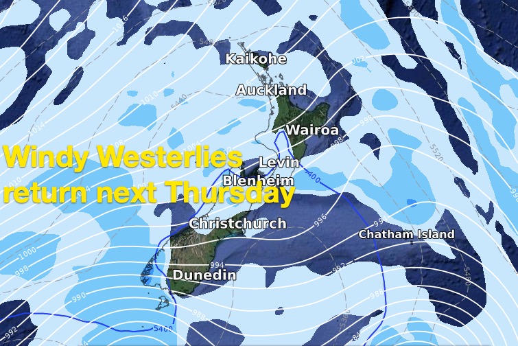
Winds may reach gale force as far north as the North Island.
Snow is possible to low levels (perhaps a couple of hundred metres).
Rain will be heavy on the West Coast with snow heavy in the mountains.
WeatherWatch.co.nz – for 10 day, hourly data for all locations in NZ.


WeatherWatch.co.nz – Exclusive
Comments
Before you add a new comment, take note this story was published on 1 Apr 2020.


Add new comment
Terrin on 2/04/2020 1:44am
Dear Philip and the team at weather watch,
Will Gisborne get really cold during this cold southerly blast
Reply
WW Forecast Team on 2/04/2020 4:40am
Hi Terrin
Use these maps: http://weathermap.co.nz/forecast-maps
Select the temperature option then using the drop down menu go to your desired date in the future, zoom in on the map for the North Island and you’ll get an idea what the temperatures will be looking like. These are the same maps we have here at WeatherWatch but they go out a bit further using that site.
Cheers
Aaron
Reply