Low pressure over the North Island, colder in the South Island (+6 Maps to Wednesday)
20/06/2021 9:57pm

> From the WeatherWatch archives
A complex low pressure system is located over the North Island and is heading to the east of the North Island today.
Rain totals in excess of 50 mm are forecast in some coastal part of Gisborne region on Monday and maybe Northern Hawke’s Bay.
Also, Thunderstorms are possible in east coastal part of the North Island on Monday night.
Gusty winds exceeding 80 km/h are likely in coastal parts of Wellington and Marlborough region from Monday morning through noon. Wind peaks ease on Tuesday but it will be still blustery in many North Island coastal areas.
Much of NZ will be covered with a high pressure zone from Tuesday onwards, although we still have some wet weather areas in the mix.
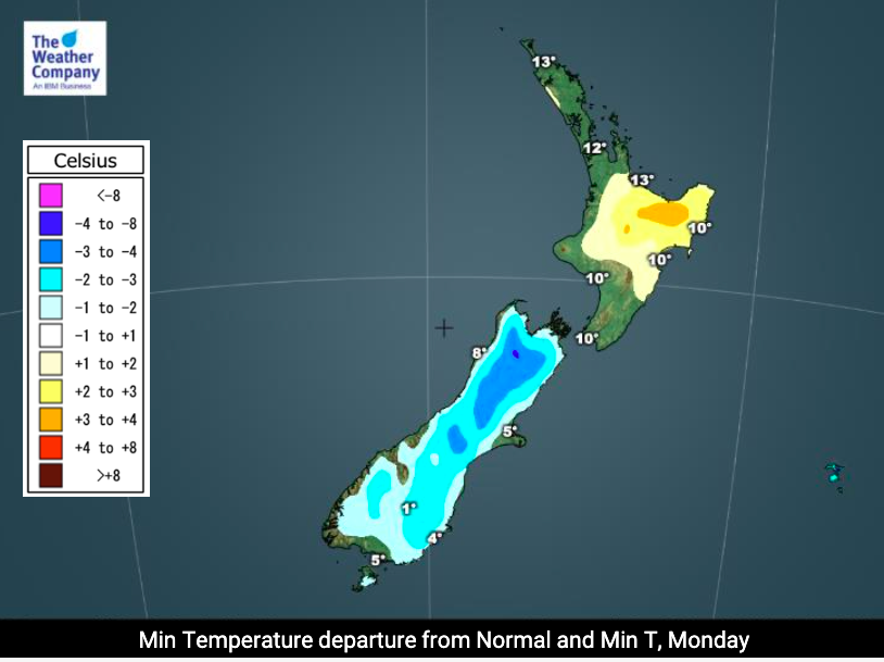
Daytime temperatures are expected to actually be average to above average for the next few days – however, nighttime temperatures are forecast to continue colder than normal with the southern part of the South Island expected to be below freezing on Wednesday.


Latest Video

Snow, rain showers & cold polar southerlies set to return
Friday will be a wintry day across NZ as the next cold front arrives, bringing snow to lower levels of…
Related Articles
Snow, rain showers & cold polar southerlies set to return
Friday will be a wintry day across NZ as the next cold front arrives, bringing snow to lower levels of…

Frosts, late week rain & another cold weekend coming
High pressure will cross NZ over the next few days meaning more cold nights/mornings with frosts, but a nor’wester will…

NZ: Cold & windy, then calm & frosty
Downpours, some squally with the chance of thunderstorms and even small tornadoes are possible for parts of NZ over Friday…

