Large area of low pressure now beginning slow track over NZ (+5 Maps)
20/08/2018 3:05am

> From the WeatherWatch archives
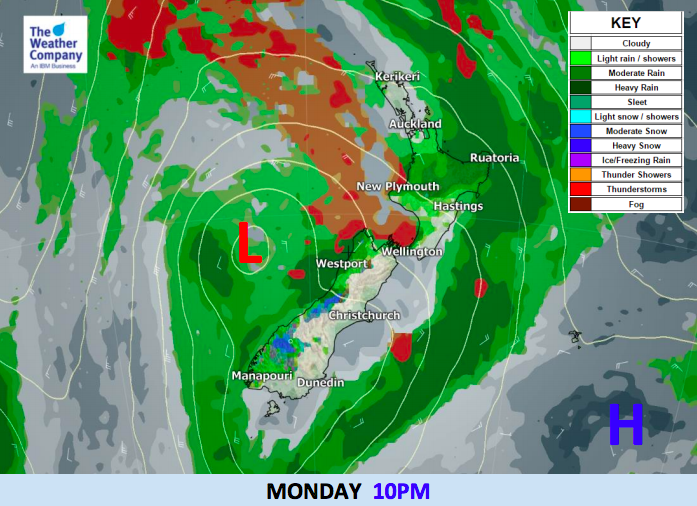
A big area of low pressure in the Tasman Sea is starting to move on to New Zealand and will take until Friday to finally move away. Rain and showers are spreading into western and northern areas during Monday bringing a milder than average day – but cooler air is coming for the South Island this week as the low moves in, while the North Island remains fairly cloudy, with rain and showers mostly in the west.
A cold front related to the Tasman Sea low will produce a few thunderstorms in the North island today and the Tasman Sea side of the South island. There are risks of localised heavy rain, lightning and isolated strong wind gusts, but generally conditions are not “stormy” across the country. Hourly rainfall totals of 30mm will be possible.
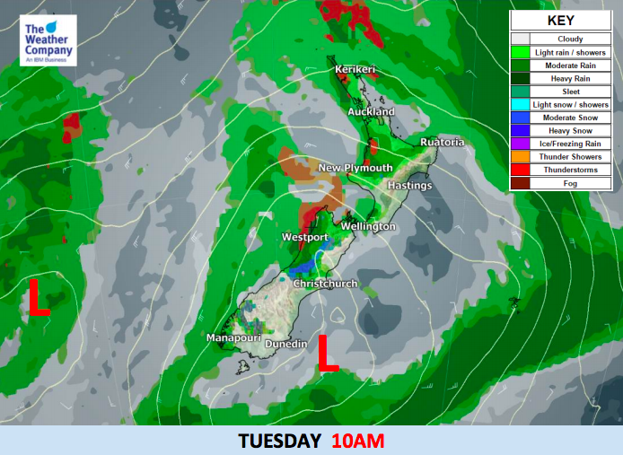
Brisk winds of 20-30 km/h will be possible across the North Island and in coastal area of the South Island with stronger gusts with some downpours. The cold front will move into the South Pacific on Tuesday. However, the large low centre behind the cold front will continue to cross New Zealand bringing some isolated thunderstorms in the Tasman Sea side of both islands and showers. Unsettled weather and strong winds will continue in a number of areas, although the air flow should see mild and sometimes sunny/fairly dry weather in the east of the North Island.
Snow will also fall in the high mountains of the South Island – the snow levels lower later on Wednesday with Thursday/Friday the coldest days in the South Island (and spreading into the North Island as a sou’wester before fading into the weekend as high pressure returns).
MONDAY:


TUESDAY:

– WeatherWatch.co.nz
Latest Video

Wintry blast coming this weekend, everyone will feel the temperature drop
A significant cold change is coming in this weekend, starting as early as Friday for the lower South Island and…
Related Articles
Wintry blast coming this weekend, everyone will feel the temperature drop
A significant cold change is coming in this weekend, starting as early as Friday for the lower South Island and…

Tracking the showers & a potential wintry blast late next week
NZ is on the edge of high pressure with anticyclones moving through at times over the next several days bringing…

Some polar airflows but more high pressure to affect NZ’s weather
Showers are in the forecast over the next several days, we track where and when they occur – but there…

