Large anticyclone promises a settled rest of the week (+5 Maps)
30/04/2018 11:10pm

> From the WeatherWatch archives
A massive high from the west is coming New Zealand’s way and unlike the one last week which brought a lot of gloomy weather this one may be a sunnier system for most.
Weather Highlights:
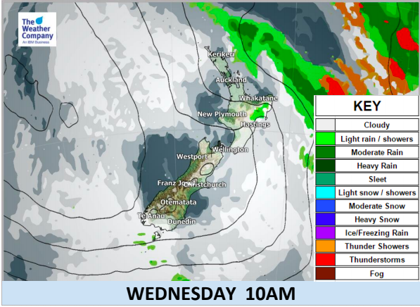
- Good weather with calm winds are expected in most part of the country after remaining showers clear tonight and early Wednesday.
- A period of showers is possible in the eastern part of both islands during Tuesday evening due to unstable air.
- On Tuesday night minimum temperatures in lower South Island will be significantly low. Then on Wednesday night 1-digit values in minimum temperatures will spread over the North Island.
- Cloudiest weather next couple of days looks to be around Southland, Hawke’s Bay and Gisborne.
- This period of good weather will persist until the weekend when a cold front and windier conditions move into the South Island on Saturday, then the North Island in a much more weakened state on Sunday.


– WeatherWatch.co.nz (Proud to be an official IBM business partner)
Latest Video

Cold weekend, frosts return with high pressure, then a low late next week
The subantarctic airflow spreads over NZ today/tonight and into Saturday, dropping temperatures nationwide. Snow flurries are possible today to lower…
Related Articles
Cold weekend, frosts return with high pressure, then a low late next week
The subantarctic airflow spreads over NZ today/tonight and into Saturday, dropping temperatures nationwide. Snow flurries are possible today to lower…

Wintry burst of weather: Snow, squally showers then sunshine & frosts
A polar change (another one!) arrives on Friday for the South Island and goes nationwide on Saturday, leaving NZ under…

Antarctic southerly for parts of NZ Fri & Sat
For the first time this year a southerly from off Antarctica is heading towards the South Island, followed by more…

