> From the WeatherWatch archives
The weather forecast for New Zealand’s first national holiday in 4 and half months doesn’t look as settled as many will be hoping for.
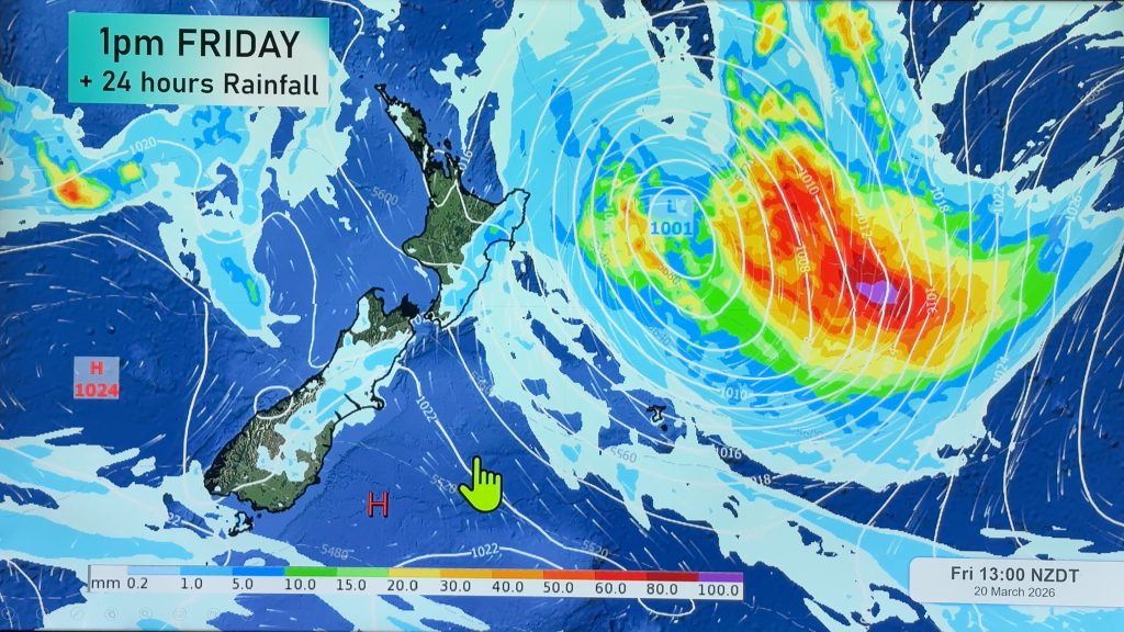
A low is expected to develop in the central Tasman Sea on Wednesday and deepen – possibly enough to prompt rain warnings for some northern & western areas – by Friday or Saturday.
Head weather analyst Philip Duncan says it’s likely to be a mostly North Island event, signalling the South Island may be the place to be this long weekend. “It’s likely to be a completely opposite forecast to last year where the further north you were the better the weather. This year northern New Zealand may be the wettest and windiest place to be”.
The low is expected to track across much of the North Island on Saturday potentially creating heavy rain for Northland, Coromandel Peninsula and Bay of Plenty. Taranaki and Nelson may also receive heavy rain.
“It’ll hardly be a suprise that the weather this holiday weekend might not be 100% settled…seems to be a bit of a kiwi tradition!” says Duncan.
The Weather Watch Centre predicts there’s a 60% chance of a wet start to Labour Weekend across the northern and western regions of New Zealand but says by Sunday conditions should clear from the west “relatively quickly”.
The South Island may be under a ridge of high pressure which could last through much of the weekend bringing mainly settled weather although cloud and easterlies created by the low may keep temperatures down – especially along the east coast.
The Radio Network’s Weather Watch Centre produces 7 day long range forecasts for holiday weekends but points out that, particularly at this time of year, forecasts can change. “We produce these long range forecasts ahead of other organisations to help kiwis be better prepared for their holiday weekends. Obviously a lot can change in 7 days during spring so as the week progresses we’ll fine tune the details”.
Don’t forget to check back later in the week (From Thursday evening) for our in depth Travel Forecast – for those driving, flying or travelling by ferry on Friday night/Saturday morning and then again for those returning late on Monday.
Outlook for this week:
Meanwhile the week ahead looks a little warmer than the past few days have been. Daytime highs in some regions were down several degrees during the weekend due to the cold southerly change that arrived on Friday. This week a mix of north’westers and sou’westers will keep temperatures fluctuating with rain or showers for a number of places – especially the south and west.
The Tasman Sea low, mentioned in the Labour Weekend forecast, will create cloud and a change to north easterlies by Thursday or Friday for the upper North Island.
Comments
Before you add a new comment, take note this story was published on 19 Oct 2008.


Add new comment
m on 23/10/2020 11:50pm
such excellent service u provide
Reply
WW Forecast Team on 24/10/2020 9:57am
Thanks very much 🙂
– WW
Reply