
> From the WeatherWatch archives
A warmer than average winter and autumn across New Zealand has seen little snow events across our mountains and ski fields – and few frosts too (until today!).
The placement of air pressure systems over the past two months have favoured plenty of mild sub-tropical rain events over cold sub-antarctic wintry blasts.
While snow has fallen across the mountains and some ski fields, especially in the South Island, northern areas have missed out on decent snow for the most part.
Mt Ruapehu is gradually gaining more snow – and more is likely in July as we see an uptick in wetter, colder, southerlies. However we also see a few mild events, somewhat sub-tropical and above average for July.
With New Zealand now in a neutral weather pattern, and no longer El Nino, we are certainly open to more southerlies and cold air – it’s just that we’ve seen an Autumn pattern continue into winter this year. Perhaps those days are starting to run out a bit now, especially after our coldest morning of the year so far today.
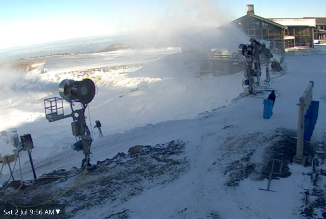
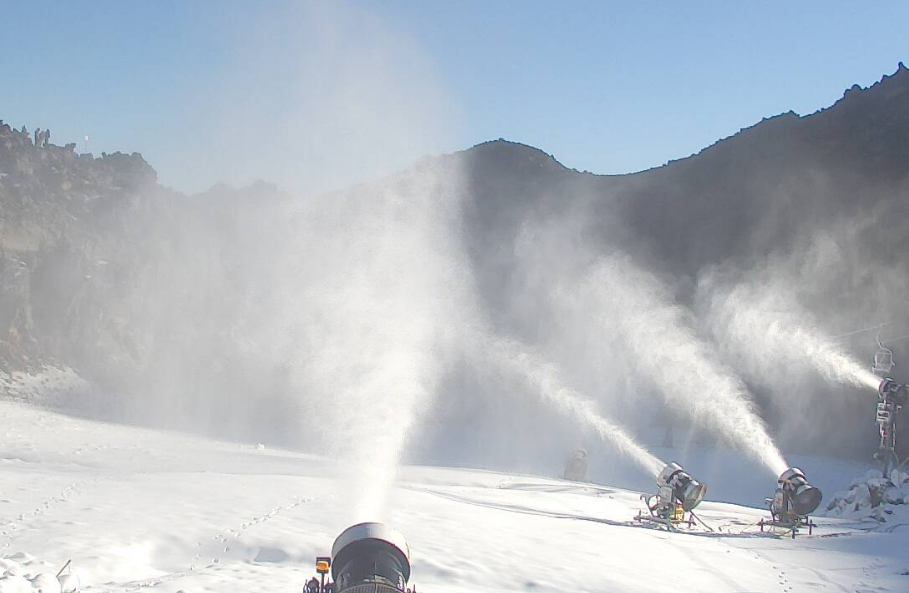
The cold weather – which saw severe frosts across both North Island and South Island ski fields this morning – means snow makers can kick in. Check out the snow making action going on right now on Mt Ruapehu where it’s still -2 degrees (in webcam images below).
However daytime highs for Whakapapa, for example, reach 11 degrees today and a mild 14 degrees tomorrow.
There may be a snow event around July 9 for Mt Ruapehu which could deliver a solid snow dump. Fingers crossed!
The South Island ranges have a better chance for more regular snow events in the coming two weeks, but it may not fall to lower levels of all ski fields. Sub-zero temperatures overnight will be good for snow making though.
The general pattern for the first half of July shows a combination of warmer than average weather but also some decent cold snaps which could produce briefly heavy snow events for the mountains with the July 9 event being the only one that sees snow possible as low down as the Desert Road and Waiouru in Central Plateau.
WeatherWatch.co.nz now has 10 day forecasts for all of New Zealand’s ski fields – simply use our free App or go to the homepage of our website and search in the forecast box for the ski field of your choice.
 TUROA SKI FIELD
 WHAKAPAPA SKI FIELD
 MT RUAPEHU SKI FIELD
 CORONET PEAK SKI FIELD
– TEMPERATURE MAP / 6am air temp map for NZ on July 10 shows many places closer to zero degrees.
– WeatherWatch.co.nz
Latest Video

Cold weekend, frosts return with high pressure, then a low late next week
The subantarctic airflow spreads over NZ today/tonight and into Saturday, dropping temperatures nationwide. Snow flurries are possible today to lower…
Related Articles
Cold weekend, frosts return with high pressure, then a low late next week
The subantarctic airflow spreads over NZ today/tonight and into Saturday, dropping temperatures nationwide. Snow flurries are possible today to lower…

Wintry burst of weather: Snow, squally showers then sunshine & frosts
A polar change (another one!) arrives on Friday for the South Island and goes nationwide on Saturday, leaving NZ under…

Antarctic southerly for parts of NZ Fri & Sat
For the first time this year a southerly from off Antarctica is heading towards the South Island, followed by more…

