
> From the WeatherWatch archives
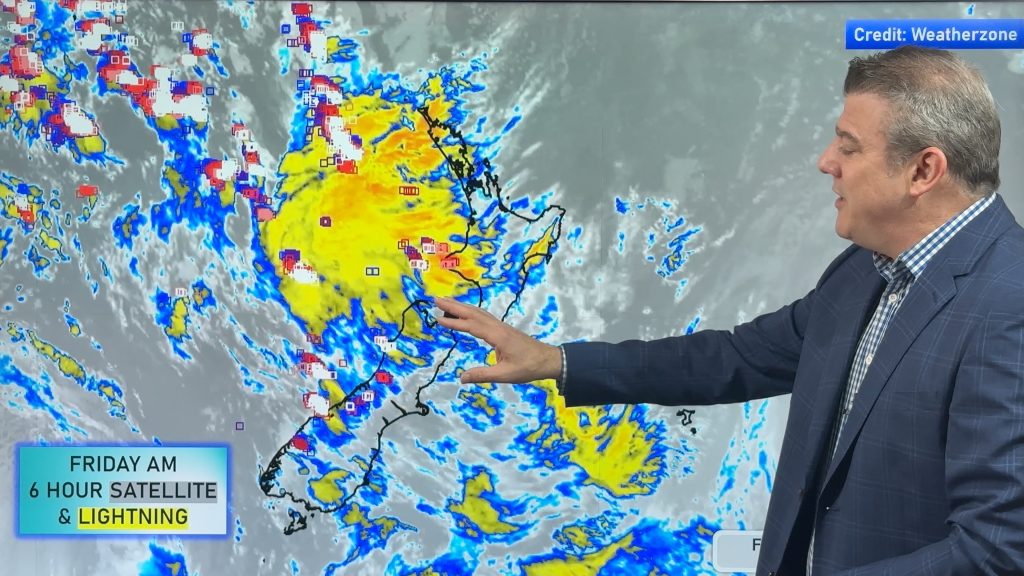
It’s been a wild 24 hours across the country and ex-cyclone Ita is in no hurry to leave – but the storm is now slowly unwinding.
Compared to Lusi, Ita picked up strength as it moved through the Tasman – it also came in from the north west, a direction that puts New Zealand in a far more vulnerable position for severe weather.
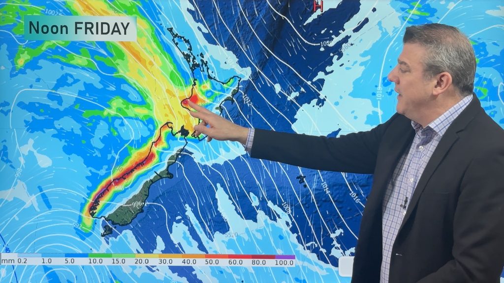
Ita is west of the South Island and across Good Friday and into the weekend the low is likely to remain put, but will slowly begin to unwind.
WeatherWatch.co.nz first informed the national media about Ita over a week ago, and told some media outlets – such as CountryTV – two weeks ago about the serious risks of this storm. Many people vented on social media sites yesterday complaining the nation wasn’t adequately warned. MetService had at least 24 warnings in force across Thursday.
Over the next few days expect conditions to gradually improve but heavy showers, isolated thunderstorms and a few bands of rain are still in the mix. Eastern and north eastern areas may well be the sunniest and warmest over the long weekend.
Image /mandenomoments.com
– WeatherWatch.co.nz
Comments
Latest Video
Thunderstorms & downpours as cold front moves through
More heavy downpours and thunderstorms are expected across Friday and into Saturday as a cold front moves through and clears…
Related Articles
Thunderstorms & downpours as cold front moves through
More heavy downpours and thunderstorms are expected across Friday and into Saturday as a cold front moves through and clears…
Cold front incoming, rain, showers and thunderstorms in the mix
Low pressure in the Tasman Sea is moving into the South Island and will bring more heavy West Coast rain…

ClimateWatch: JUNE outlook as El Niño continues to build
June has kicked off in NEUTRAL again as far as El Niño is concerned, but it is expected to form…


Guest on 18/04/2014 9:22am
Is it unusual for us to get the remains of two cyclones in a year, i can’t remember two in one year but i am bound to be wrong.Is it due to an abnormal weather pattern or not uncommon and will this have any bearing on winter
Guest on 18/04/2014 1:19am
All these people complaining on social media sites weren’t aware of a giant cyclone in Aus heading to NZ? Right …