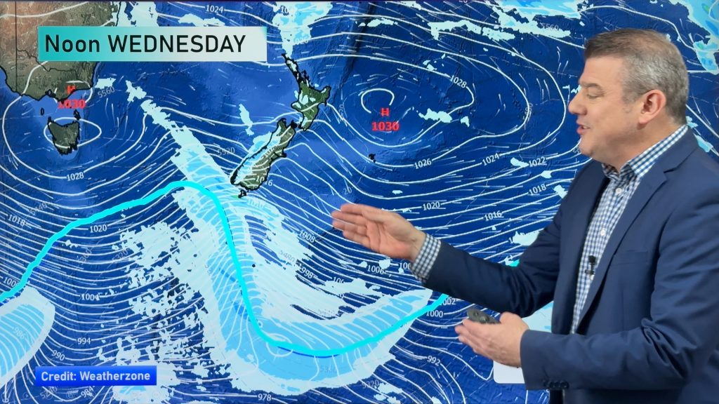
InfoGraphic: The Big Picture for Wednesday / Thursday
25/09/2018 7:00pm

> From the WeatherWatch archives
A strong cold southwesterly airflow lies over New Zealand today, easing in the evening and overnight. A cool southwesterly airflow continues over New Zealand on Thursday.
Cloudy areas and showers at times for the western North Island today, drier out east however a few showers push into Wairarapa around midday then moving further north late afternoon or evening. Dry for a majority of the South Island however expect showers for Greymouth northwards in the west, showers for Southland and Otago for much of the day also (especially the southern half of Otago, longer dry spells further north). Expect snow flurries about the far south to 100m in the morning then lifting to 300 to 400m in the evening. A few flurries about the ranges of Buller to 500m during the day.
Sunny spells and the odd shower for most North Island regions on Thursday, showers may become a bit more persistent in the afternoon / evening Waikato eastwards (especially about hills / ranges) then clearing later in the evening. Mainly dry for most of the South Island on Thursday, showers about Southland however pushing into Otago during the afternoon. Showers also about the mountains / hills of Buller, Nelson and Marlborough from afternoon then clearing at night.

By Weather Analyst Aaron Wilkinson – WeatherWatch.co.nz
Comments
Before you add a new comment, take note this story was published on 25 Sep 2018.


Add new comment