
> From the WeatherWatch archives
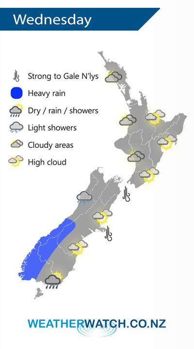
A northwesterly airflow lies over New Zealand on Wednesday, becoming strong over the South Island. A cold front moves onto the lower South Island from afternoon moving northwards to reach the lower North Island overnight.
A mix of sun and cloud for the western North Island on Wednesday, cloud thicker about Taranaki and Kapiti during the day with the chance of a light shower or two. Rain moves into the southwestern North Island overnight. Mostly sunny with a touch of high cloud for the east coast.
Cloudy for the West Coast of the South Island, rain about South Westland becomes heavy from afternoon then pushing northwards in the evening. Expect plenty of high cloud in the east. Rain moves into Southland areas midday then Otago late afternoon or evening with a west to southwest change.
By Weather Analyst Aaron Wilkinson – WeatherWatch.co.nz
Latest Video

NZ: 8 Day outlook as gales & rain ease, high pressure builds
Damaging wind gusts and heavy rain will continue to affect some parts of the North Island and brushing Marlborough today…
Related Articles
NZ: 8 Day outlook as gales & rain ease, high pressure builds
Damaging wind gusts and heavy rain will continue to affect some parts of the North Island and brushing Marlborough today…

Pockets of hit & miss heavy rain, snow moves northwards
Low pressure continues to slowly move across the upper North Island and for some that will bring the sun out,…

Slow go for northern low & southern cold
For the next few days low pressure will crawl over the upper North Island, driving in rain as far south…

