
> From the WeatherWatch archives
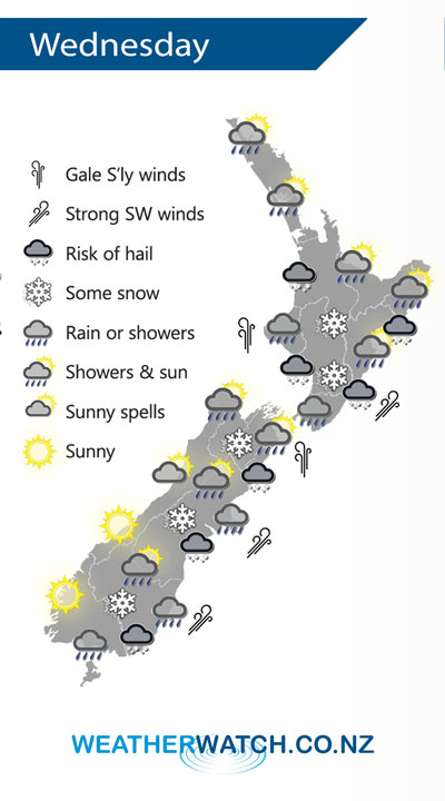
A strong cold southerly airflow over the South Island spreads over the North Island on Wednesday bringing rain with a risk of heavy falls and hail. Also some snow about the Central Plateau.
Rain or showers for most regions on Wednesday, there may be hail at times also. Some inland parts of the South Island may stay quite sheltered apart from an initial burst of precipitation in the morning. Snow to low levels (200 to 100m) from Southland through to Canterbury, 400m about Marlborough through to the Central North Island in the evening.
Winds blustery and cold from the south or southwest, gales through Cook Strait.
By Weather Analyst Aaron Wilkinson – WeatherWatch.co.nz
Latest Video

Cold weekend, frosts return with high pressure, then a low late next week
The subantarctic airflow spreads over NZ today/tonight and into Saturday, dropping temperatures nationwide. Snow flurries are possible today to lower…
Related Articles
Cold weekend, frosts return with high pressure, then a low late next week
The subantarctic airflow spreads over NZ today/tonight and into Saturday, dropping temperatures nationwide. Snow flurries are possible today to lower…

Wintry burst of weather: Snow, squally showers then sunshine & frosts
A polar change (another one!) arrives on Friday for the South Island and goes nationwide on Saturday, leaving NZ under…

Antarctic southerly for parts of NZ Fri & Sat
For the first time this year a southerly from off Antarctica is heading towards the South Island, followed by more…

