
> From the WeatherWatch archives
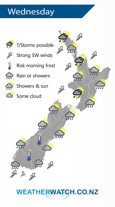
A front clears off to the northeast of the North Island early on Wednesday morning then expect a cold southwesterly airflow for the rest of the day.
Showers for the western North Island may be heavy with thunderstorms during Wednesday, easing in the evening. Snow lowers to 800m about the Central North Island. For the east coast expect some morning rain then the odd shower and sunny spells. Winds brisk from the southwest in the west, perhaps strong at times.
For the South Island most rain / shower activity is about Southland although a few showers may affect other regions further north at times, some snow about Southland and Otago down to 400m, perhaps 300m at times.
By Weather Analyst Aaron Wilkinson – WeatherWatch.co.nz
Latest Video

NZ: 8 Day outlook as gales & rain ease, high pressure builds
Damaging wind gusts and heavy rain will continue to affect some parts of the North Island and brushing Marlborough today…
Related Articles
NZ: 8 Day outlook as gales & rain ease, high pressure builds
Damaging wind gusts and heavy rain will continue to affect some parts of the North Island and brushing Marlborough today…

Pockets of hit & miss heavy rain, snow moves northwards
Low pressure continues to slowly move across the upper North Island and for some that will bring the sun out,…

Slow go for northern low & southern cold
For the next few days low pressure will crawl over the upper North Island, driving in rain as far south…

