
> From the WeatherWatch archives
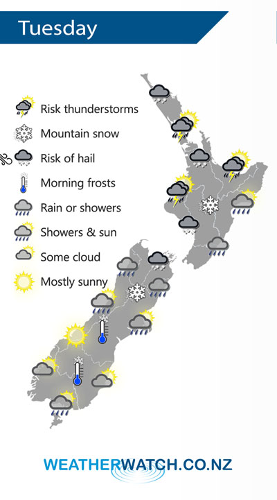
A cold south to southwesterly airflow over the South Island spreads over the North Island on Tuesday.
Showers, becoming heavy with a risk of thunderstorms and hail in the afternoon for the upper North Island as southwesterlies freshen. Conditions ease later in the evening. Rain develops about Wellington and Wairarapa in the morning then spreading northwards into Hawkes Bay and Gisborne in the afternoon. Snow lowers about the Central Plateau overnight to 600m.
Rain or showers about the upper South Island eases during the day, gradually clearing from the south. Morning snow to 300m about Canterbury then clearing, 500m for Marlborough; gradually lifting and clearing. Fairly dry about the lower South Island but the odd shower may pester Southland, mainly in the morning.
By Weather Analyst Aaron Wilkinson – WeatherWatch.co.nz
Latest Video

Cold fronts continue, wind & rain for some Fri/Sat
Wet weather is moving over the North Island today, while the South Island has drier skies – ahead of another…
Related Articles
Cold fronts continue, wind & rain for some Fri/Sat
Wet weather is moving over the North Island today, while the South Island has drier skies – ahead of another…

Cold fronts vs high pressure
A cold front is moving up NZ today and into Tuesday, but will fall apart as it heads north and…

Wintry change coming for SI and lower NI
Some wet weather, along with a drop in temperatures, will move into the lower South Island later on Sunday and…

