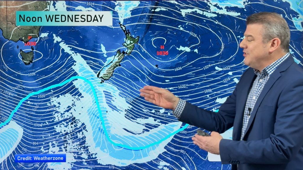
InfoGraphic: The Big Picture for Thursday / Friday
3/04/2019 6:00pm

> From the WeatherWatch archives
An anticyclone covers most of New Zealand today, a cold front moves onto the lower South Island this morning reaching the upper South Island later this evening / overnight. A large anticyclone to the southwest directs a cold southerly airflow over the South Island on Friday, this southerly airflow gradually pushes over the North Island during the day.
Morning cloud or showers clears the upper North Island today then mostly sunny, showers ease and clear Gisborne this afternoon. Morning cloud clears Hakwes Bay then mostly sunny. A sunny day for Wairarapa, Wellington and up through to Taranaki. Rain or showers (possibly heavy) moves onto the lower South Island this morning, showers move into Canterbury later in the evening. Canterbury has a mostly sunny day overall, Nelson and Marlborough have a sunny day also.
A mix of sun and cloud for the upper North Island on Friday, chance of a shower or two otherwise mainly dry, winds from the south. Showers about Wairarapa, becoming heavy in the afternoon then pushing northwards reaching Hawkes Bay in the evening. Some cloud for the lower western North Island, may be a shower in the afternoon as southeasterlies freshen. Showers for the eastern South Island may be heavy in the morning then gradually easing, risk of a shower out west then cloud breaking away by evening.

By Weather Analyst Aaron Wilkinson – WeatherWatch.co.nz
Comments
Before you add a new comment, take note this story was published on 3 Apr 2019.


Add new comment