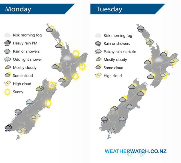
InfoGraphic: The Big Picture for Monday / Tuesday
26/08/2018 7:00pm

> From the WeatherWatch archives
A ridge brings mainly settled weather to the North Island today, a north to northwesterly airflow lies over the South Island. A low churns away west of New Zealand in the Tasman Sea on Tuesday, an east to northeasterly airflow gradually increases over the country during the day.
Mainly settled for the North Island today with light winds, areas of cloud especially in the west this morning. There may even be some morning fog about the Waikato. The South Island has mostly cloudy skies in the west with the odd light shower, some rain moves into southern Fiordland this afternoon bringing heavy falls. Dry in the east with a touch of high cloud for some.
Thickening cloud across much of the North Island on Tuesday, chance of a shower or two from afternoon in the west. Rain moves into Northland by evening then pushes southwards overnight. Mostly sunny for the east coast with some high cloud. The South Island sees cloudy skies and patchy showers / drizzle develop in the east, morning cloud may break to some sun along the West Coast. Showers or drizzle about Fiordland for much of the day.

By Weather Analyst Aaron Wilkinson – WeatherWatch.co.nz
Comments
Before you add a new comment, take note this story was published on 26 Aug 2018.


Add new comment