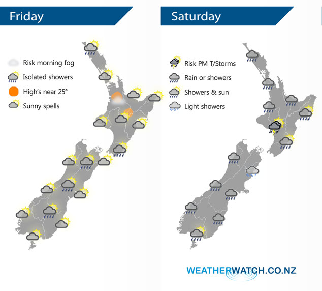
InfoGraphic: The Big Picture for Friday / Saturday
22/11/2018 6:00pm

> From the WeatherWatch archives
A big low pressure system brews away in the Tasman Sea today meanwhile a northeasterly airflow develops over New Zealand. This big low flings a front over New Zealand on Saturday bringing some wet weather to most regions, rain may be heavy about the northeastern side of the North Island.
Mainly dry for most of the North Island today, a few showers move into Northland in the evening then spreading to Auckland by midnight. There may be a shower or two along the east coast. A mix of sun and cloud for most of the South Island, a few isolated showers possible about inland areas (about the high country) late afternoon / evening then clearing.
Showers for most North Island regions today, a period of rain in the morning about Northland through to Waikato then Bay Of Plenty / East Cape in the afternoon may be heavy. Chance of a rumble of thunder about the southwestern corner of the North Island in the afternoon. The South Island sees areas of rain or drizzle for most regions, Central Otago is looking mainly dry till afternoon, Southland has a mainly dry day with only the chance of a shower late evening.

By Weather Analyst Aaron Wilkinson – WeatherWatch.co.nz
Comments
Before you add a new comment, take note this story was published on 22 Nov 2018.


Add new comment