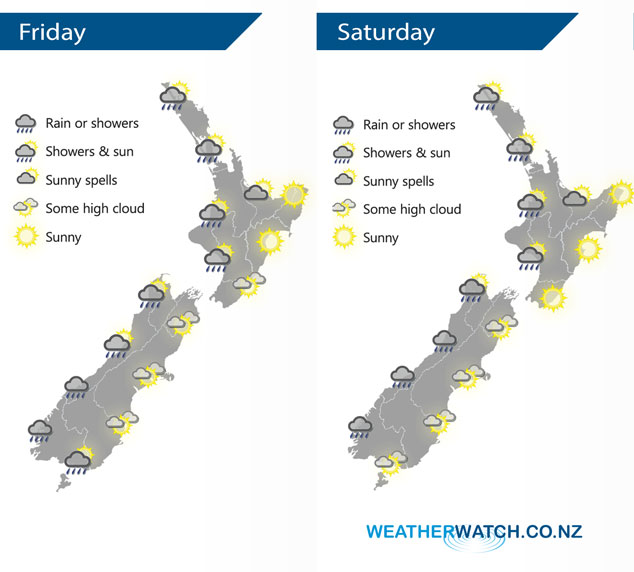
InfoGraphic: The Big Picture for Friday / Saturday
14/06/2018 7:00pm

> From the WeatherWatch archives
A northwesterly airflow develops today. Still fairly settled although showers start to affect western regions, the West Coast of the South Island from morning then the western side of the North Island later this afternoon or evening. Saturday continues to see a northwesterly airflow over the country.
Mostly sunny for the eastern North Island today, cloud gradually increases in the west however and a few showers move in from afternoon about Taranaki and elsewhere this evening. The West Coast of the South Island has showers for much of the day, especially South Westland. Drier out east although there may be some low cloud about this morning then areas of high cloud from afternoon. Spots of rain at times about Southland, Otago and perhaps South Canterbury.
Occasional showers for western regions on Saturday, Auckland and Northland may see long dry periods compared to elsewhere. Drier in the east with some high cloud, especially for the South Island.
By Weather Analyst Aaron Wilkinson – WeatherWatch.co.nz
Latest Video

Cold weekend, frosts return with high pressure, then a low late next week
The subantarctic airflow spreads over NZ today/tonight and into Saturday, dropping temperatures nationwide. Snow flurries are possible today to lower…
Related Articles
Cold weekend, frosts return with high pressure, then a low late next week
The subantarctic airflow spreads over NZ today/tonight and into Saturday, dropping temperatures nationwide. Snow flurries are possible today to lower…

Wintry burst of weather: Snow, squally showers then sunshine & frosts
A polar change (another one!) arrives on Friday for the South Island and goes nationwide on Saturday, leaving NZ under…

Antarctic southerly for parts of NZ Fri & Sat
For the first time this year a southerly from off Antarctica is heading towards the South Island, followed by more…

