> From the WeatherWatch archives
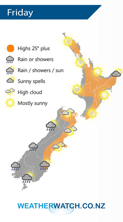
A westerly airflow lies over the North Island on Friday meanwhile a cool change / front pushes northwards over the South Island.
Mostly sunny for much of the North Island on Friday, there may be a few areas of morning cloud for the upper North Island and Kapiti then breaking away. High cloud increases moving in from the west afternoon onwards. The odd shower moves into Taranaki and Kapiti in the evening then spreading into other southwestern parts of the North Island overnight.
Rain pushes northwards along the West Coast of the South Island during the day, easing evening. Showers about Southland push into Otago around midday then reaching Canterbury in the evening, a chance as these showers push northwards through Otago and Canterbury they may be heavy with the low risk of a thunderstorm.

By Weather Analyst Aaron Wilkinson – WeatherWatch.co.nz
Comments
Before you add a new comment, take note this story was published on 12 Dec 2019.


Add new comment