How much rain will you get this weekend? The latest rainfall estimates (+4 Maps)
9/02/2018 10:15pm

> From the WeatherWatch archives
The low this weekend north west of New Zealand is large but weak and it’s tapping into moisture rich sub-tropical air. A blocking high pressure system to the east of the country is slowing down these rain bands.
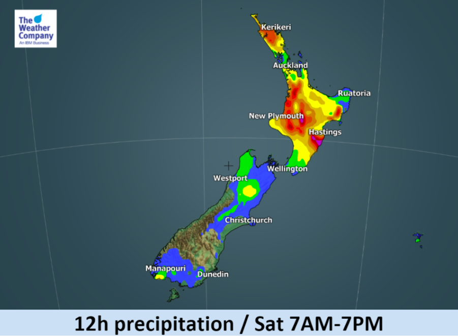
Here’s the latest outlook by our meteorologists at the Weather Company showing forecast rainfall accumulations in 12 hour segments for New Zealand.
One positive is that for drought affected regions of the lower North Island there looks like some relief will be coming.
Rain will be patchy with drizzle, dry spells and heavy set in downpours across several regions until Monday or even Tuesday.
Highlights:
- Rain accumulation for 12 hours may exceed 50mm in some areas.
- As the front moves southeastward, the area of heavy showers will follow. Tonight and tomorrow daytime the heaviest rainfall is expected in the Tasman and western part of the North Island.
- Temporarily heavy rainfall and isolated thunderstorms could also occur especially over interior regions in the North Island and in the vicinity of the front.
- Localised flooding is possible.
- Drizzle and dry spells will also be in the mix.
- Humidity will hit 100% at times with low cloud and even fog/mist.


– These maps are created by meteorologists specifically for WeatherWatch.co.nz by the Weather Company (an IBM Business).
– WeatherWatch.co.nz (an official IBM business partner)
Latest Video

Temperature changes for some regions ahead of heavy West Coast rain
A nor-wester is about to kick in and it’s coming from out of Australia, boosting temperatures in some regions going…
Related Articles
Temperature changes for some regions ahead of heavy West Coast rain
A nor-wester is about to kick in and it’s coming from out of Australia, boosting temperatures in some regions going…

NZ 7 day forecast: Showers, temp changes and heavy West Coast rain
NZ has a fairly messy forecast over the next 7 days, but the main feature will be heavy rain on…

Cold fronts continue, wind & rain for some Fri/Sat
Wet weather is moving over the North Island today, while the South Island has drier skies – ahead of another…

