

> From the WeatherWatch archives
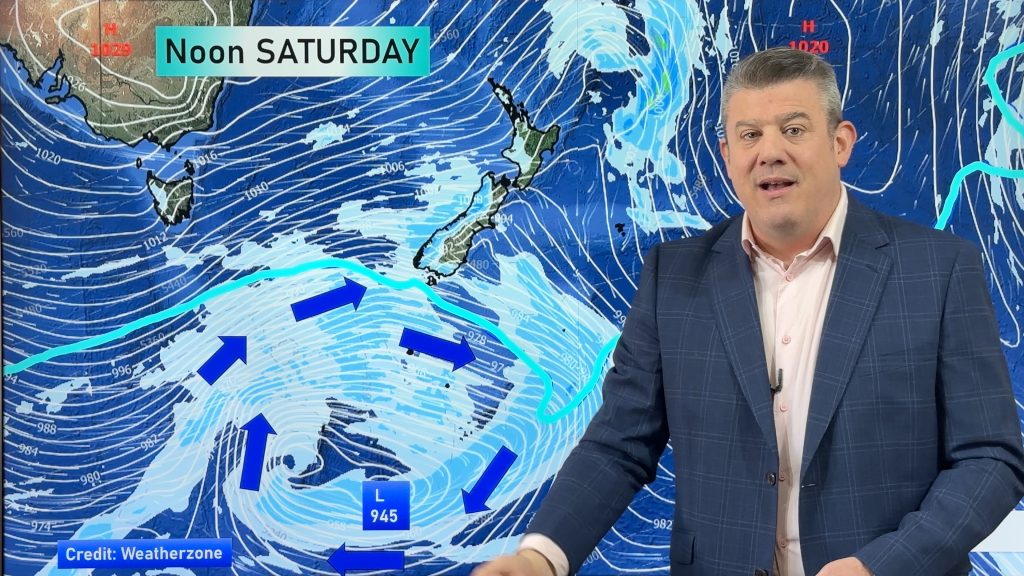
A large high that has brought stunning weather to Sydney this week is trying its best to bring settled weather here for Saturday – but it’s not going to succeed in any great manner.
While parts of the country will enjoy some sunny weather this weekend the high will have very little to do with it. Pushing eastwards from New South Wales – where it has brought fresh mornings and stunning days – it will only clip the upper North Island.
.jpg) In fact, the centre of the high won’t cover land, instead just as it’s about to the incoming southerly low will nudge the high back northwards again into the sub-tropics.
In fact, the centre of the high won’t cover land, instead just as it’s about to the incoming southerly low will nudge the high back northwards again into the sub-tropics.
Unlike the wind that was created earlier this week by the large departing high the next belt of wind is entirely driven by a large low coming out of the Southern Ocean.
This will crank up across the country across the weekend.
Meanwhile today the remnants of the low that crossed the country earlier in the week will remain to the east of the North Island bringing more rain and showers into south eastern areas.
Light rain and a few showers may also push into the West Coast.
– Image / showing the high (blue) to the north west of NZ while the incoming Southern Ocean low pushes gales (in red) west of the South Island / Weathermap.co.nz
– WeatherWatch.co.nz
Comments
Latest Video
Weekend gales, frosts & polar air next week
Low pressure is today over the upper North Island, replaced by a surge of gale west to south-west winds this…
Related Articles
Weekend gales, frosts & polar air next week
Low pressure is today over the upper North Island, replaced by a surge of gale west to south-west winds this…
Rain, showers, frosts – then windy again
In true early-spring fashion we have more windy weather on the way, but first low pressure is crossing the country…
Cold front, low pressure, then windy westerlies kick back in
A cold front is today and tomorrow moving into the country, with coldest weather in the southern half of the…


sw on 11/05/2012 7:30am
Here the high because of its weakness and positioning actually wrecks our weather,it be better if a proper high moved in or another depression arrives thus keeping us in a westerly flow (rather than to SW) would actually be better.