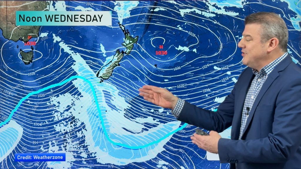
Gales and snow for the south as front moves up the country
7/08/2014 2:00am

> From the WeatherWatch archives
Gale-force winds hammered the lower South Island this morning as a front moves over the country, bringing a cold change that is likely to dump snow to sea level later today.
Severe weather warnings are in place for much of the lower South Island, with strong wind warnings for Southland, Otago and Canterbury.
Heavy snow warnings are in place for Fiordland, Southland and Clutha, while a heavy rain warning is in place for the ranges of Westland south of Otira.
Strong westerly and northwesterly winds were already gusting up to 160km/h as the front moved over the South Island.
The front would be followed by a cold change that would see temperatures plummet, bringing snow to low levels in warning areas.
The Foveaux Strait was being battered by 100km/h winds, gusting up to 160km/h, while 60km/h gales in Invercargill were gusting up to 120km/h.
Strong winds were also hammering Otago, with 50km/h northwesterly winds in Dunedin gusting up to 80km/h.
In Fiordland, snow below 300m was expected from this afternoon, becoming heavy this evening. Heavy snow would follow in Southland and Clutha from about midnight.
Snow was likely to push further north tomorrow, with southern parts of Central Otago and Dunedin expected to see some snow to low levels, but not in large amounts.
Heavy rain was falling in Westland this morning, with 30-40mm of rainfall in the ranges since midnight. The rain was not expected to ease until this afternoon.
Strong winds were also expected in the lower North Island later today. The wind was already blustery in Wairarapa, with a severe weather watch for gales in place.
– NZ Herald
Comments
Before you add a new comment, take note this story was published on 7 Aug 2014.


Add new comment