Frosty cold nights fade as sub-tropical winds return. July ends on a calm note (+6 Maps)
26/07/2020 8:12pm

> From the WeatherWatch archives
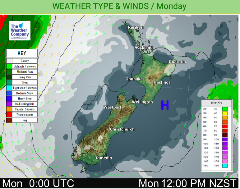
An anticyclone lies smack bang over NZ for Monday bringing frosts, light winds and more gloomy low clouds in Auckland to begin the day with – but milder weather is coming.
The clear skies and light winds along with the long dark nights help make for frosts, especially through inland parts of the South Island. But the milder flow will start to lift the South Island up overnight tonight (while the North Island remains cooler than average in a number of spots).
WeatherWatch.co.nz says most days this week are leaning warmer than normal across New Zealand for this time of the year.
Over the next two days this big high drifts from being directly over us (currently with light winds and the cold nights) to being east of us (creating easterlies and milder northerlies both by day and night).
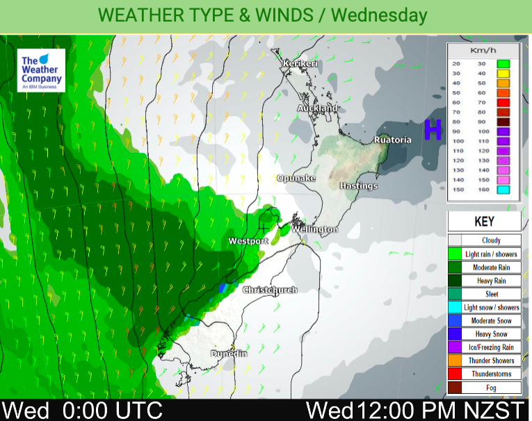
By mid to late this week sub-tropical winds kick back in nationwide (or at least in parts of both islands).
This week starts off with cold nigths and calm weather and ends with milder days and nights, West Coast rain clouds and a mild end to July and start to August.
August kicks off this weekend and by then New Zealand will be stuck between two powerful highs – one to the east and the other to the west. A small low to the north of NZ may then pull down some sub-tropical rain into parts of the North Island.
WeatherWatch.co.nz says this is not NZ’s typical winter pattern for this time of year and proves once again being two small mountainous islands partially in the roaring forties means our weather patterns are often messy.


Latest Video

Antarctic southerly for parts of NZ Fri & Sat
For the first time this year a southerly from off Antarctica is heading towards the South Island, followed by more…
Related Articles
Antarctic southerly for parts of NZ Fri & Sat
For the first time this year a southerly from off Antarctica is heading towards the South Island, followed by more…

Meteors – Your Eyewitness Reports!
WeatherWatch.co.nz receives meteor reports from all over New Zealand and the globe, 24/7/365. **CASUAL COMMENTS**If you’ve seen something in the…

Snow, rain showers & cold polar southerlies set to return
Friday will be a wintry day across NZ as the next cold front arrives, bringing snow to lower levels of…

