Friday’s weather headlines (x3): Front moves in, A new development, Chilly mornings inland South Island from Sunday
10/03/2022 6:00pm
> From the WeatherWatch archives
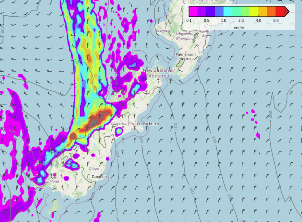
FRONT ARRIVES ON SCHEDULE
A front is pushing northwards over the South Island today on schedule, some heavy rain can be expected in the west as it moves through, this morning about South Westland then further north this afternoon. Nice warm temperatures in the east though with highs likely to get into the mid to late twenties. Christchurch has a high of 28.
A NEW DEVELOPMENT, LOW BRINGS RAIN TO THE EASTERN NORTH ISLAND NEXT WEEK
A low pressure system looks to hang around the North Island all of next week just to the northeast, it directs in a south to southeasterly airflow bringing an extended period of rain for the east coast. The exact ins and outs of this low will likely change a bit as we move forward but something to take note of.
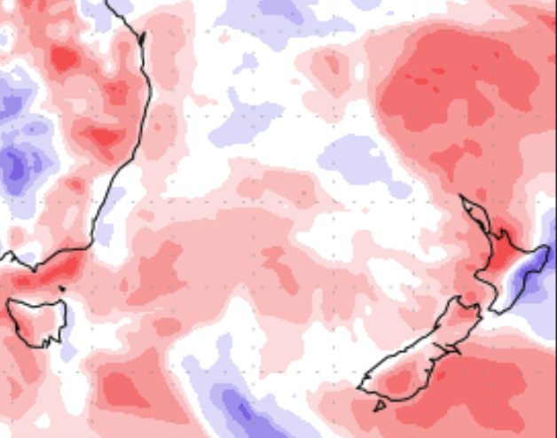
Even the precipitation percentage of normal map has changed, basically red is drier than normal and blue is wetter than normal.

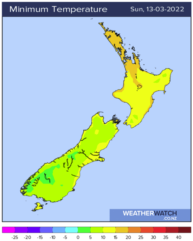
A BIT CHILLY INNER SOUTH ISLAND FROM SUNDAY MORNING
While the eastern North Island is looking a bit wet next week the South Island is a bit calmer, anywhere skies are clear the night before it will likely be a bit cold overnight Sunday on wards. We aren’t exactly into frost territory just yet but lows of 3 or 4 degrees in the mornings are possible.
Latest Video

More heavy rain, snow – but large dry areas, especially as we go into the long weekend
Heavy rain will continue for parts of Canterbury and Marlborough over the next day or two and it will gradually…
Related Articles
More heavy rain, snow – but large dry areas, especially as we go into the long weekend
Heavy rain will continue for parts of Canterbury and Marlborough over the next day or two and it will gradually…

Large low brings rain, downpours & some snow – gets colder as the week progresses
Low pressure will cross the upper North Island in the days ahead and that set-up actually pushes more heavy rain…

WeatherWatch App launches real-time local lightning tracker!
A bolt out of the blue! WeatherWatch has launched a live, real-time lightning tracker, enabling Kiwis to gain access to data provided by the…

