Friday’s National Forecast – Wet weather moves into the NI, a cooler change in the SI (+6 Maps)
7/01/2021 3:00pm

> From the WeatherWatch archives
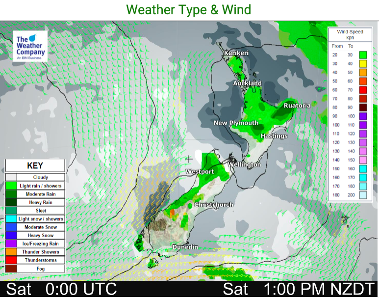
A cold front moves into the North Island from the Tasman Sea today and falls apart. Daytime heating may contribute to a few downpours through the North Island.
A southerly change moves up the South Island and will spark a few downpours in the upper western Southern Alps.
The southerly will also create a colder than average day across much of the eastern side of NZ. Many other regions will likely be above average.
To make more sense of today and the days ahead please refer to your LOCAL and HOURLY forecasts. Have a great to end to your week!


Latest Video

Antarctic southerly for parts of NZ Fri & Sat
For the first time this year a southerly from off Antarctica is heading towards the South Island, followed by more…
Related Articles
Antarctic southerly for parts of NZ Fri & Sat
For the first time this year a southerly from off Antarctica is heading towards the South Island, followed by more…

Meteors – Your Eyewitness Reports!
WeatherWatch.co.nz receives meteor reports from all over New Zealand and the globe, 24/7/365. **CASUAL COMMENTS**If you’ve seen something in the…

Snow, rain showers & cold polar southerlies set to return
Friday will be a wintry day across NZ as the next cold front arrives, bringing snow to lower levels of…

