Friday’s national forecast – Snow, SI ranges
21/09/2023 12:00pm

> From the WeatherWatch archives
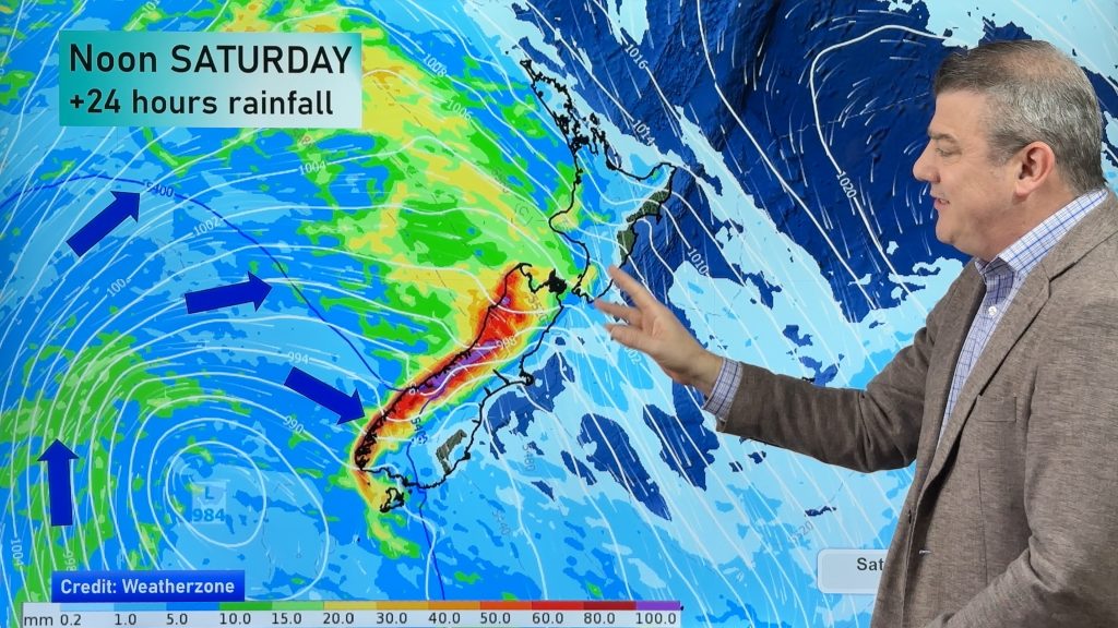
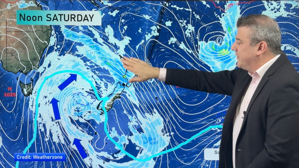
Our front slowly moves northwards over the South Island today bringing rain, heavy about the Main Divide and Canterbury high country. A snow risk exists also, please check out our warnings page for the latest information from Metservice. Northerlies for the North Island with cloud and a few showers, dry in the east.
Northland, Auckland, Waikato & Bay Of Plenty
Mostly cloudy with the odd shower, north to northeasterly winds.
Highs: 18 – 20
Western North Island (including Central North Island)
Partly cloudy with the odd shower, cloud may be thicker in the morning for most and about coastal areas during the day. North to northwesterly winds.
Highs: 15 – 20
Eastern North Island
Mainly sunny and warm with north to northwesterly winds.
Highs: 20 – 24
Wellington
Mostly cloudy with a few spits or showers, rain overnight. Gusty north to northwesterly winds.
Highs: 16 – 17
Marlborough & Nelson
Spits or showers for Nelson and about the Sounds, spreading into eastern Marlborough from afternoon. During the evening rain sets in, becoming heavy later in the day or overnight. Gusty north to northwesterly winds ease later in the day.
Highs: 17 – 18
Canterbury
Cloudy with rain south of Banks Peninsula, moving north in the afternoon, rain is heavy for inland areas (in the high country). Heavy snow south of Banks Peninsula to 600m in the high country, perhaps down to 400m for South Canterbury. North Canterbury sees snow fall to 800m in the evening, perhaps a touch lower overnight, heavy snow above these levels. Southerly winds.
Highs: 6 – 18
West Coast
Rain with heavy falls, perhaps some thunder. Rain becomes heavy for Buller during the afternoon as a front pushes northwards meanwhile conditions ease simultaneously further south. Fiordland is dry from morning with sun. Breezy northerlies change to the south.
Highs: 13 – 16
Southland & Otago
Mostly cloudy for Southland, chance of a shower. Otago has rain (heavy in the north), easing from afternoon as a front slowly pushes away to the north, snow lowers to 500m (heavy in the north, easing from afternoon). Southerlies tend east to southeast after midday.
Highs: 8 – 10
Comments
Before you add a new comment, take note this story was published on 21 Sep 2023.


Add new comment