Friday’s national forecast – Rain storm eyes up South Island (+8 maps)
15/07/2021 4:00pm

> From the WeatherWatch archives
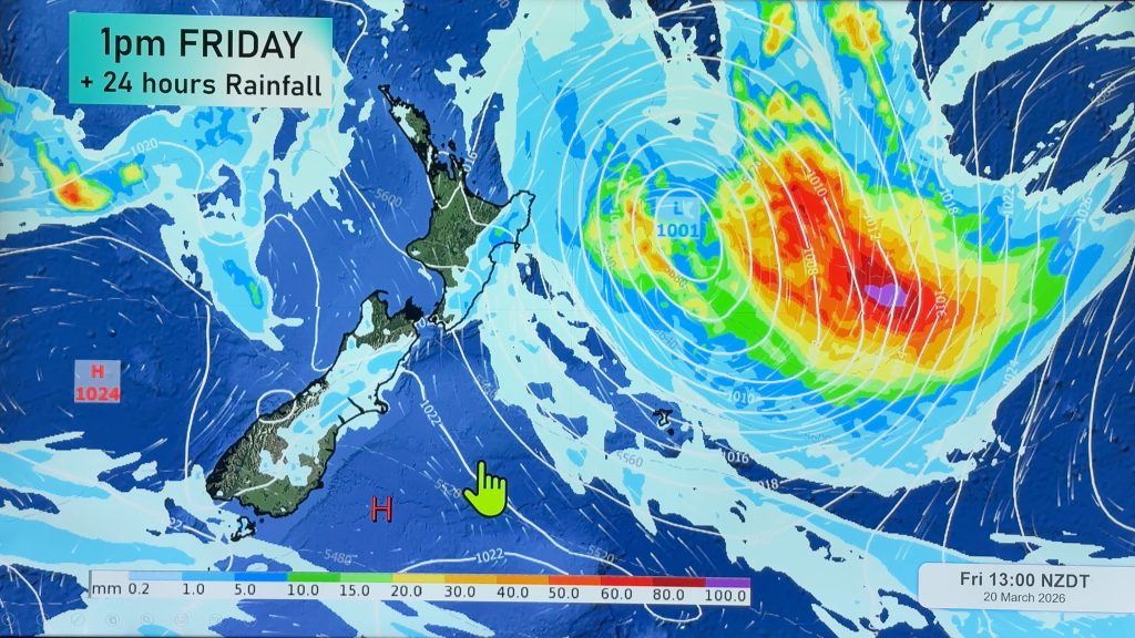
A frontal system moves over the South Island today bringing very heavy rain for the West Coast, northwesterlies for the North Island bring a warm day for the east coast.
Very heavy rain for the West Coast today, northerly winds about the upper South Island and through Cook Strait will be very strong also, gales likely about coastal areas, severe gales developing through Cook Strait. This evening and overnight winds pick up about the western North Island becoming strong with coastal gales once again.
Please refer to your local, hourly, 10 day forecast for more details.
Northland, Auckland, Waikato & Bay Of Plenty
Cloudy areas and occasional sun, a shower or two also mainly from afternoon. Northerlies freshen after midday becoming gusty overnight.
Highs: 16-17
Western North Island (including Central North Island)
Cloudy, a few showers for Taranaki and Kapiti. Later in the evening rain starts to become more widespread, becoming heavy in the aforementioned areas. North to northwesterly winds freshen, strong overnight for coastal areas with gales.
Highs: 10-16
Eastern North Island
Sunny areas and some high cloud, high cloud thickens later in the day. Overnight spits of rain for southern Wairarapa. North to northwesterly winds pick up from afternoon, gusty overnight.
Highs: 15-18
Wellington
Cloudy, perhaps a few spits of rain. In the evening rain moves in becoming widespread then perhaps heavy overnight. Northerlies strengthen rising to gale force in the morning, severe gales through Cook Strait.
High: 14-15
Marlborough & Nelson
Rain for Nelson, spits spreading into Marlborough at times. In the evening rain becomes widespread and heavy especially overnight. Northerlies strengthen during the day rising to gale force at times from afternoon.
Highs: 13-16
Canterbury
Cloudy, mainly dry right on the coast but inland about the foothills and high country expect rain for much of the day, heavy in the high country, easing in the evening. The odd spit may reach the coast at times. Northerly quarter winds, gusty about North Canterbury.
Highs: 8-16
West Coast
Very heavy rain, starting to ease from evening. Strong northerly winds, gales about the coast then easing later in the day. Fiordland sees heavy rain ease from afternoon.
Highs: 12-15
Southland & Otago
Some scattered rain for Southland, clearing in the afternoon and there may be some sun before dusk. Otago has scattered rain also, mainly for a time in the afternoon, staying mostly cloudy. Northeasterly winds tend to the north in the afternoon.
Highs: 8-11


Comments
Before you add a new comment, take note this story was published on 15 Jul 2021.


Add new comment