
> From the WeatherWatch archives
A cool southwesterly airflow eases over the country today, a finger of moisture stretches out from the Tasman later in the day bringing some rain to the western North Island.
Northland, Auckland, Waikato & Bay Of Plenty
Some cloud and occasional sun, the odd shower from evening then rain later on pushing in from the west. Rain may become heavy overnight about south Auckland and the Waikato. Fresh southwesterly winds.
Highs: 18-20
Western North Island (including Central North Island)
Mostly cloudy with occasional showers, manly morning then again in the evening. Southwesterlies tend west to northwest in the afternoon.
Highs: 11-17
Eastern North Island
Morning showers clear then expect cloudy areas and occasional sun, fresh cool southwesterly winds die out in the evening.
Highs: 15-18
Wellington
Cloudy areas and the risk of a shower, mainly this morning. Fresh southerly winds ease later in the day.
High: 14
Marlborough & Nelson
Chance of an early shower then sunny spells break through, cloud clears away in the evening. Light winds.
Highs: 14-17
Canterbury
Any morning showers clear then expect sunny spells, cool southwesterly winds die out in the evening.
Highs: 10-13
West Coast
Areas of cloud with the chance of a shower or two, many long dry periods also. Light south to southwesterly winds.
Highs: 11-15
Southland & Otago
Cloudy areas and the chance of a shower or two through till evening, mainly about coastal areas. Some sun will gradually become more frequent from afternoon. Southwesterly winds.
Highs: 12
By Weather Analyst Aaron Wilkinson – WeatherWatch.co.nz
Latest Video
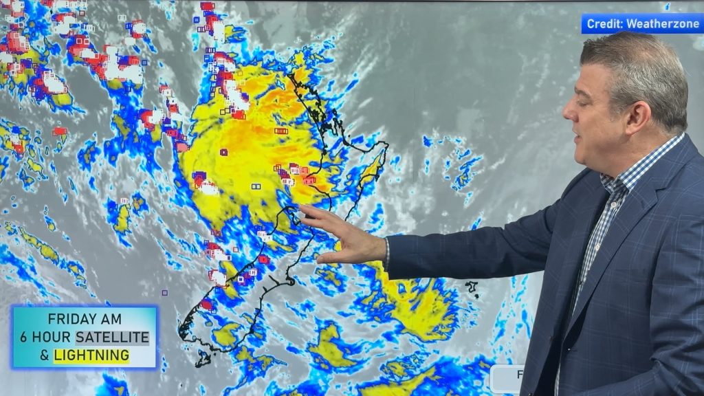
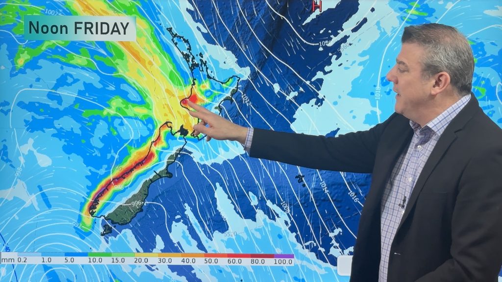
Thunderstorms & downpours as cold front moves through
More heavy downpours and thunderstorms are expected across Friday and into Saturday as a cold front moves through and clears…
Related Articles
Thunderstorms & downpours as cold front moves through
More heavy downpours and thunderstorms are expected across Friday and into Saturday as a cold front moves through and clears…
Cold front incoming, rain, showers and thunderstorms in the mix
Low pressure in the Tasman Sea is moving into the South Island and will bring more heavy West Coast rain…

ClimateWatch: JUNE outlook as El Niño continues to build
June has kicked off in NEUTRAL again as far as El Niño is concerned, but it is expected to form…

