Easter Sunday’s national forecast – Rain moves across both islands
20/04/2019 4:00pm

> From the WeatherWatch archives
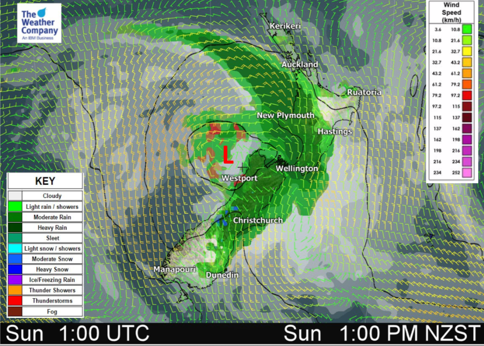
We have plenty of rain, showers and drizzle across NZ today as a cold front and associated weak low pressure system move into the North Island.
The southerly change in the south will drop temperatures and bring rain in to the north and along the eastern side (while clearing from the south west). It will move into the lower North Island later in the day.
Meanwhile the North Island has a rain band moving in with some heavy falls but dry and sunny in the north and east to start with.
Please refer to your local hourly WeatherWatch.co.nz forecast for more details – we have over 2000 NZ locations!
Also you can get more details from our special Official Easter Weekend forecast here.
NORTH ISLAND:
Rain moving in from the west with heavy falls around Taranaki – then heading northwards into Waikato and Auckland etc later in the day or at night. A cooler southerly arrives in the lower North Island later. Sunniest and warmest weather will be around Gisborne but sunny skies should greet plenty in the upper North Island this morning too.
Highs: 14 to 22
SOUTH ISLAND:
Rain around the upper and eastern sides of the island but clearing in the west and south. A colder southerly moves in, bringing rain and showers into Canterbury. Sunniest weather today most likely in Southland but showers possible inland.
Highs: 12 to 17
– WeatherWatch.co.nz
Latest Video

Cold weekend, frosts return with high pressure, then a low late next week
The subantarctic airflow spreads over NZ today/tonight and into Saturday, dropping temperatures nationwide. Snow flurries are possible today to lower…
Related Articles
Cold weekend, frosts return with high pressure, then a low late next week
The subantarctic airflow spreads over NZ today/tonight and into Saturday, dropping temperatures nationwide. Snow flurries are possible today to lower…

Wintry burst of weather: Snow, squally showers then sunshine & frosts
A polar change (another one!) arrives on Friday for the South Island and goes nationwide on Saturday, leaving NZ under…

Antarctic southerly for parts of NZ Fri & Sat
For the first time this year a southerly from off Antarctica is heading towards the South Island, followed by more…

