Downpours & thunder in the north, colder with snow in the south (+5 Maps)
21/08/2018 10:53pm

> From the WeatherWatch archives
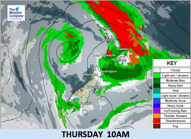
More downpours, isolated thunderstorms and even hail are forecast for the upper North Island of New Zealand as a large scale low pressure system continues to very slowly cross over the country for Wednesday and Thursday.
This showery set up will bring heavy downpours and isolated thunderstorms along western and northern areas, mainly Auckland, Northland and possibly Bay of Plenty later, but some may spread furth south into Taranaki and Waikato. Locally heavy rainfall is possible especially around the ranges in the central and upper North Island.
The flip side of this set up is that a big chunk of the South Island is drier than average for the next week ahead, but the next few days will be colder there with showers, falling as snow flurries above 500m.
A colder sou’wester sweeps over NZ by Thursday night and Friday, easing by the end of Saturday as a large high rolls in from the Tasman Sea and this large area of low pressure from NZ continues to be pushed eastwards away from us over the South Pacific Ocean.
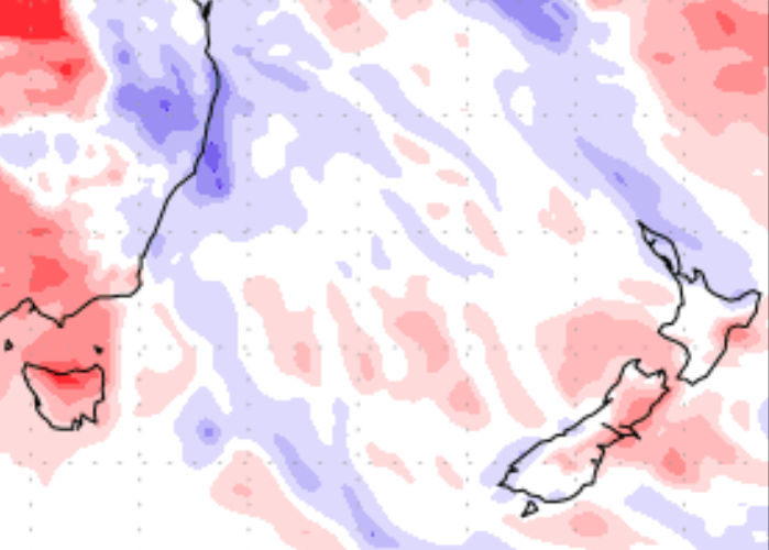
7 DAY RAINFALL MAP COMPARED TO NORMAL
(Red = drier than average, White = average rainfall, Blue = wetter than average). Data by the US Government.


– WeatherWatch.co.nz
Latest Video

Cold weekend, frosts return with high pressure, then a low late next week
The subantarctic airflow spreads over NZ today/tonight and into Saturday, dropping temperatures nationwide. Snow flurries are possible today to lower…
Related Articles
Cold weekend, frosts return with high pressure, then a low late next week
The subantarctic airflow spreads over NZ today/tonight and into Saturday, dropping temperatures nationwide. Snow flurries are possible today to lower…

Wintry burst of weather: Snow, squally showers then sunshine & frosts
A polar change (another one!) arrives on Friday for the South Island and goes nationwide on Saturday, leaving NZ under…

Antarctic southerly for parts of NZ Fri & Sat
For the first time this year a southerly from off Antarctica is heading towards the South Island, followed by more…

