
> From the WeatherWatch archives
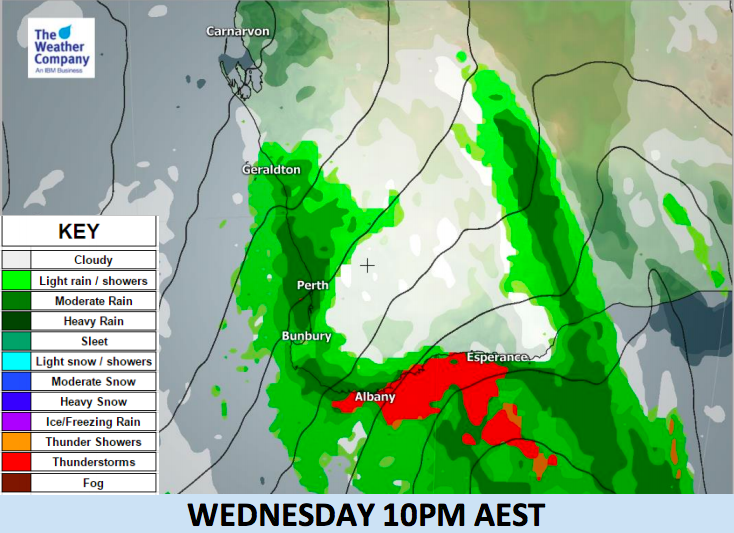
A deep trough is passing through the southwestern part of Western Australia today. A well-marked cold front will sweep the area during this morning then strong winds kick in.
A short-period intense rain is forecast (30mm/h is expected) in the vicinity of the front.
Damaging wind gusts are also expected along with likely thunderstorms. This will affect western coastal areas until Wednesday night and southern coastal areas until Thursday early morning.
Damaging winds behind the front will persist into Wednesday night. They can reach gale force (63 km/h sustained) along the western and southern coasts. Winds will be westerly at the beginning and will change to southwesterly during the afternoon.


– WeatherWatch.co.nz
Latest Video

Cold weekend, frosts return with high pressure, then a low late next week
The subantarctic airflow spreads over NZ today/tonight and into Saturday, dropping temperatures nationwide. Snow flurries are possible today to lower…
Related Articles

Snow, rain showers & cold polar southerlies set to return
Friday will be a wintry day across NZ as the next cold front arrives, bringing snow to lower levels of…

Polar airflows set to bring cold weekend to NZ
Nor-west winds will be building over parts of NZ going into Thursday with rain on the West Coast becoming heavy…

ClimateWatch: JULY outlook & what El Niño means for NZ
El Niño is officially here and still getting stronger in the months ahead, but it’s harder to notice its effects…

