
Cold change coming, northern low too
15/09/2026 12:42pm
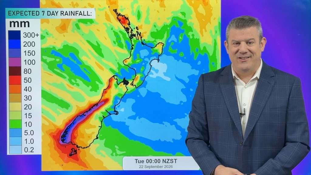
Temperatures will lift today and tonight ahead of a cold southern change tomorrow and Thursday, which will affect the southern half of the South Island the most with a burst of wintry weather again.
Despite high pressure being close to the upper North Island today and tomorrow, the centre will remain offshore, bringing a westerly to north-west flow over many regions, until that south to south-west flow comes in to the lower South Island.
The high is also dragging in “anticyclonic gloom” – or low cloud that, which is mostly affecting the western coastline of NZ.Despite high pressure being close to the upper North Island today and tomorrow, the centre will remain offshore, bringing a westerly to north-west flow over many regions, until that south to south-west flow comes in to the lower South Island.
By Friday a new low will form over or near the upper North Island. Rainfall chances keep moving around but in today’s video Northland is most exposed to heavy rain, along with the West Coast, especially the southern half.
Wind chill in Southland and Otago will be especially bleak for newborn livestock over Wednesday and/or Thursday.
Latest Video
Cold change coming, northern low too
Temperatures will lift today and tonight ahead of a cold southern change tomorrow and Thursday, which will affect the southern…
Related Articles
Next spring blast coming, we track the gales & rain
Many places will become warmer over the next few days, ahead of a cold change mid to late week. Windy…

NZ 8 day: More spring ups & downs
A surge of colder air will affect some places over today, tonight and Saturday morning, before a warmer airflow comes…
Cold front heads north, high pressure struggles to reach NZ
A burst of colder air spreads over NZ tonight but for many places Friday will be a milder day as…

