Cold change coming, felt most in the south and east of both main islands (+9 Maps)
10/05/2021 10:46pm

> From the WeatherWatch archives
Autumn has finally woken up with a cold blast not just coming in this week, but another one (or two) coming in this weekend too.
The rough weather pattern is normal for this time of year – if anything it’s taken a month or so longer to kick in.
As we reported yesterday many places are about to face a 10 degrees (or more) drop in the east of both main islands from Monday/Tuesday to Wednesday/Thursday. Many places in the east will again be several degrees warmer than normal today – but by tomorrow will be several degrees below normal.
The cold change moves into Dunedin today, Christchurch tonight, Wellington on Wednesday morning and Auckland by Wednesday evening – although the upper half of the North Island won’t necessarily have a cold front moving in with rain then a temperature drop, instead the colder air will likely become more apparent later into Wednesday and overnight into Thursday morning.
The upper North Island will again be warmer than average tonight while the South Island goes the opposite direction under the colder airflow.
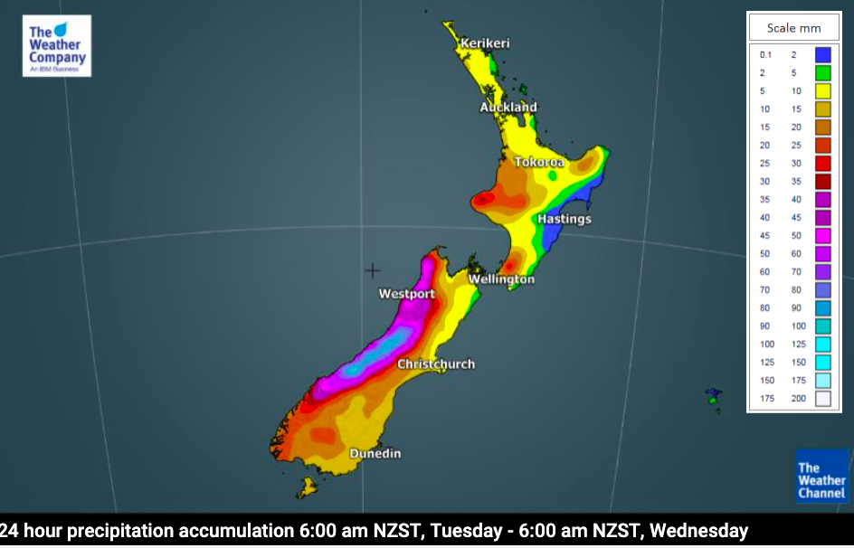
Rainfall is mostly in the west but some will make it into the eastern North Island as a wet easterly kicks in for a time. We have more details on rain for drought regions like Hawke’s Bay here.
Snow will fall across the South Island ranges and mountains and the lower and central North Island – but snow accumulations won’t be too excessive.
For the most local weather data in NZ for your area, please visit www.RuralWeather.co.nz – NZ’s Local Forecaster.


Latest Video

More eastern rain, but a drier long weekend coming
Rain continues today along the eastern South Island and lower North Island, coming in from the east with heavy falls….
Related Articles
More eastern rain, but a drier long weekend coming
Rain continues today along the eastern South Island and lower North Island, coming in from the east with heavy falls….

More heavy rain, snow – but large dry areas, especially as we go into the long weekend
Heavy rain will continue for parts of Canterbury and Marlborough over the next day or two and it will gradually…

Large low brings rain, downpours & some snow – gets colder as the week progresses
Low pressure will cross the upper North Island in the days ahead and that set-up actually pushes more heavy rain…

