ClimateWatch – May outlook for NZ is looking quite dry (+12 Maps & Video)
4/05/2021 8:44pm

> From the WeatherWatch archives
Published April 30th for the month of MAY — Our outlook for May is out and the forecast is looking dominated by powerful high pressure zones coming out of Australia, at least to begin with.
This is now the third Autumn in a row with below normal rainfall for a number of regions across New Zealand due to a significant uptick in high pressure. There is currently no solid scientific explanation for the increase in high pressure although WeatherWatch.co.nz has noted that lows circling Antarctica this year have been especially deep and stormy, perhaps indicating a drop in air pressure in the Southern Ocean area has helped lift the air pressure further north, as part of a natural balancing act.
RAIN:
It’s drier than average for the first two weeks of May, with the first several days especially dry. This is due to a strong high moving in and stalling in the eastern Tasman Sea/NZ area.
While showers and some rain from the west are more likely as we go into the middle of the month the rainfall totals may still not be that great, especially for those regions in the east now in drought.
DROUGHT:
WeatherWatch.co.nz exclusively forecast back in late December/early January that New Zealand was expected to be drier this year with an increased risk of drought, despite La Nina at the start of the year. We also advised Auckland Council publicly not to relax water restrictions with our forecast that Auckland’s water storage dams would likely struggle to refill.
So far WeatherWatch.co.nz has been the most accurate climate forecaster in NZ for the past twelve months, at a time when we’d preferred to have been wrong. The drier than usual pattern seems well established at the moment and for it to change (which is possible in a ‘neutral’ season – ie no La Nina or El Nino) it would take a big shift in the high pressure zones. They need to move north of NZ and they also need to significantly break up (more gaps of low pressure between the highs) to allow more rain makers a better chance of moving in to New Zealand.
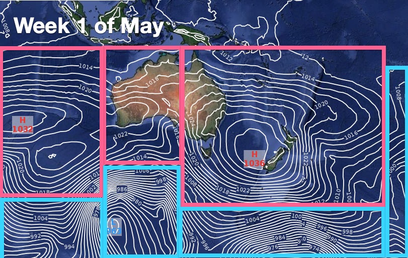
High pressure exiting Australia is the number one cause of the drier than usual weather over NZ in recent years – and this year the highs have broken up over Australia much more, allowing rain to fall there – but not much of it to reach NZ.
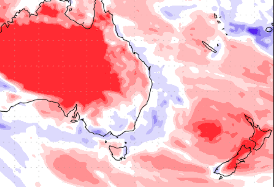
Red = Dry. Pink = Fairly dry. White = Normal rainfall. Blue = wetter than average.


HOW THE AIR PRESSURE IS BEHAVING IN MAY:
It’s all about high pressure to begin with and this will keep much of NZ drier than usual, despite some areas getting showers off and on (especially in the west).
More high pressure than average means drier than average weather. It also means it won’t be overly windy for most places considering we’re in mid-Autumn which can be quite unsettled usually.


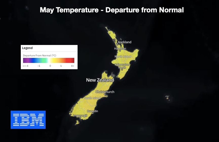
MAY’S EXPECTED TEMPERATURE TREND:
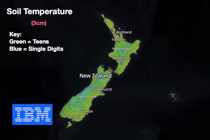
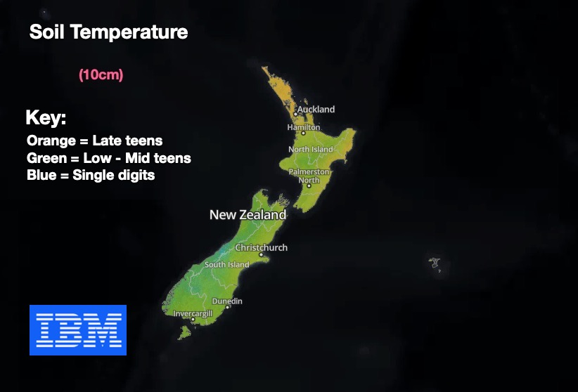
SOIL INFO:

LA NINA:
La Nina came to an end last month and now we’re in a neutral pattern. Based on this information from the Bureau of Meteorology in Australia, our part of the world will likely be in a neutral pattern for perhaps the rest of 2021. This can create a more ‘chaotic’ weather pattern which can give us more variety in our weather.


Latest Video

Wintry weather coming: Snow, rain, wind & sunshine
A cold front is moving into NZ from Friday to Sunday with low pressure developing west of NZ and then…
Related Articles
Wintry weather coming: Snow, rain, wind & sunshine
A cold front is moving into NZ from Friday to Sunday with low pressure developing west of NZ and then…

ClimateWatch: JULY outlook & what El Niño means for NZ
El Niño is officially here and still getting stronger in the months ahead, but it’s harder to notice its effects…

Low pressure heading to NZ this weekend & into next week
Many regions have settled weather at the moment with frosts as far north as Auckland this morning, but still some…

