
> From the WeatherWatch archives
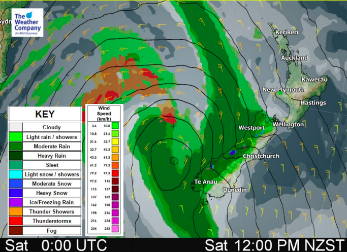
On Saturday rain is moving up the West Coast and snow will fall higher up – both are intensifying. Locally heavy downpours and bursts of snow are possible over the western half of the island with some spill over to the east.
Over 125mm of precipitation for the next 24 hours is forecast around Mount Aspiring National Park.
Gusty conditions in the east and high waves in the west should be watched as well.
The peak of strong wind is coming around noon Saturday and the peak of high wave is expected at midnight on Sunday.
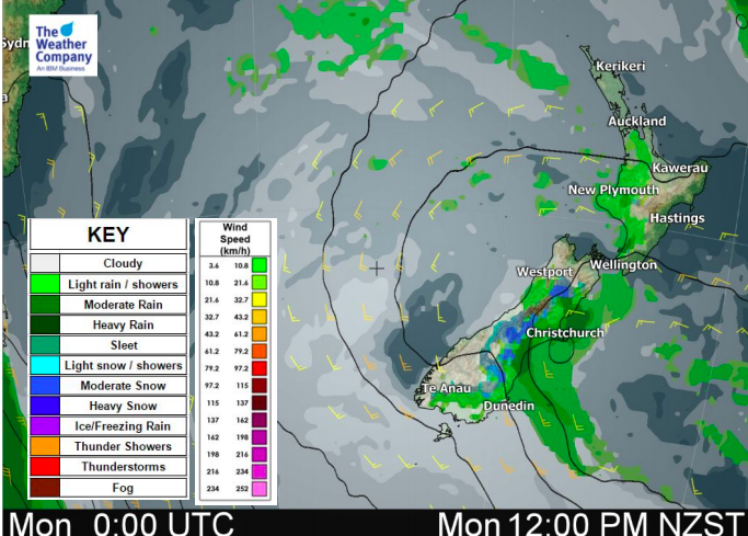
Warmer than normal conditions continue across the country this weekend but colder air arrives on Sunday and Monday. After having the trough pass and southerlies become dominant, temperatures drop down to normal early next week.


– WeatherWatch.co.nz
Latest Video

Wintry weather coming: Snow, rain, wind & sunshine
A cold front is moving into NZ from Friday to Sunday with low pressure developing west of NZ and then…
Related Articles

Polar airflow + northern low = pockets of heavy rain & snow
A colder change is coming – and so too is a large low which will develop and grow over northern…
Wintry weather coming: Snow, rain, wind & sunshine
A cold front is moving into NZ from Friday to Sunday with low pressure developing west of NZ and then…

ClimateWatch: JULY outlook & what El Niño means for NZ
El Niño is officially here and still getting stronger in the months ahead, but it’s harder to notice its effects…

