> From the WeatherWatch archives
Victorians feeling the chill
The last few nights and mornings have been noticeably cold in Victoria compared to earlier in the month, requiring residents to bring out the blankets and pullovers.
Temperatures have dropped three-to-eight degrees below average after having been just as much above average just over a week ago.
There is a much cooler and drier airmass over the region in the wake of last Friday’s strong cold front, the strongest front of the year so far. This dry and cool air has lead to nights becoming much colder.
Much of the state has now had five-or-more consecutive cooler-than-average nights. This is quite a change from earlier in the month, when it was generally above average, sometimes well above.
One of those places is Tatura, in the north of the state. Last night Tatura to 4.1 degrees, eight below average and 13 degrees colder than last Tuesday night. This is its coolest March night in four years.
Another is Ballarat, which was the coldest in the state last night, dipping to 1.4 degrees, nine below average. There hasn’t been a cooler March night in Ballarat in 13 years.
Also having its fifth consecutive cooler-than-average night was Melbourne, which last night cooled below 10 degrees for the first time this year, cooling to 9.4, four below average. This is also Melbourne’s coolest March night in four years.
Looking ahead to the rest of the week, nights will gradually warm up due to easterly winds raising the humidity again. However, there’s still a chance for a few more cooler-than-average nights this week due to light winds and fairly clear skies.
Heavy rain drenches Queenland’s Northern Tropical Coast
Parts of Queensland’s Northern Tropical Coast have seen more than 200mm of rain during the past 24 hours..
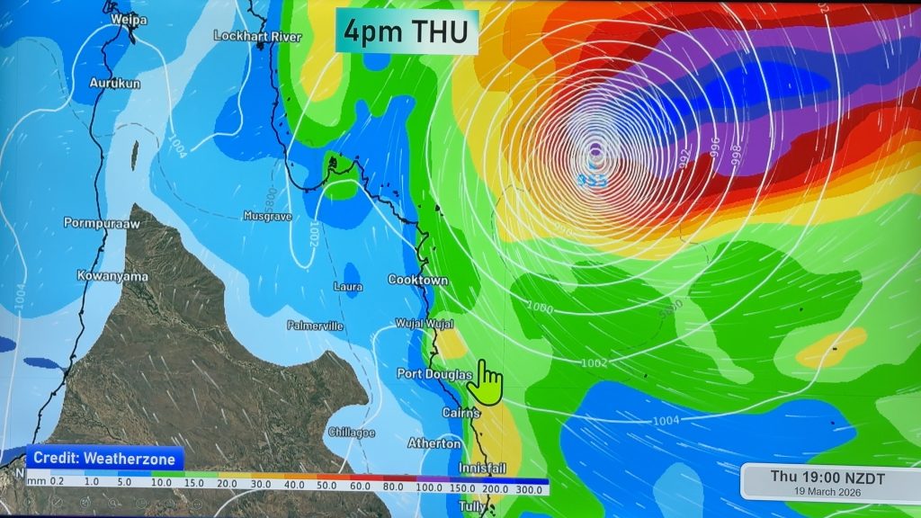
The coastal area between Cairns and Tully has copped the heaviest rain during the past 24 hours, with some areas seeing as much as 200-300mm. This rainfall is associated with a trough that is extending over the Coral Sea.
Innisfail gained 223mm of rain in the 24 hours to 9am this morning, bringing its monthly total to 1153mm. This makes it the wettest March for Innisfail in six years. Further north, Daradgee received 342mm during the past 24 hours, its wettest day since December of 2007 when 364mm fell.
The heavy rain and storms will continue today with a severe thunderstorm warning current. Severe storms are likely to produce heavy rainfall along the Northern Tropical Coast with hourly falls of 80 to 100mm possible.
Areas which may be affected today include Cairns and Port Douglas. Cairns has already seen close to 100mm in the 24 hours to 9am, bringing its monthly total to 891mm, more than double the March average.
The trough is slowly contracting north with the heavy rain expected to clear north of the region during the next 24 hours. On Tuesday, southeast winds in the wake of the trough will only trigger scattered showers, with rainfall totals expected to remain below 20mm for the day.
– Weatherzone
Comments
Before you add a new comment, take note this story was published on 26 Mar 2012.


Add new comment