Antarctic blast now up to Northland – much of NZ cold (or colder)
20/05/2017 2:39am

> From the WeatherWatch archives
Updated 2:39pm — A southerly change from around Antarctica has blasted across New Zealand today bringing snow to low levels, hail, gales and sunny spells too.
Over the past couple of hours heavy downpours have moved through Auckland dropping the temperature by a few degrees – and colder air will continue to spill over Waikato and Auckland for the rest of today.
The cold front is now crossing Northland and clearing Coromandel Peninsula.
For northern New Zealand the coldest air is only brushing by. Eastern and southern parts of both islands will be the coldest from this event.
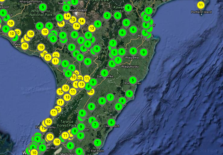
As fo 2:30pm this temperature pattern could be seen:
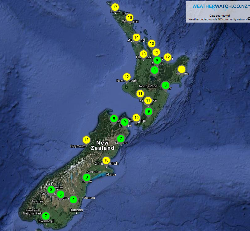 2:30pm temperature map – click for Live/Current Observations
The coldest air is affecting the south eastern corner of both the North and South Island, as you can see in the below two maps.
WeatherWatch.co.nz has been told by people especially in Hawke’s Bay, Southland and coastal Otago that conditions are bitterly cold today.

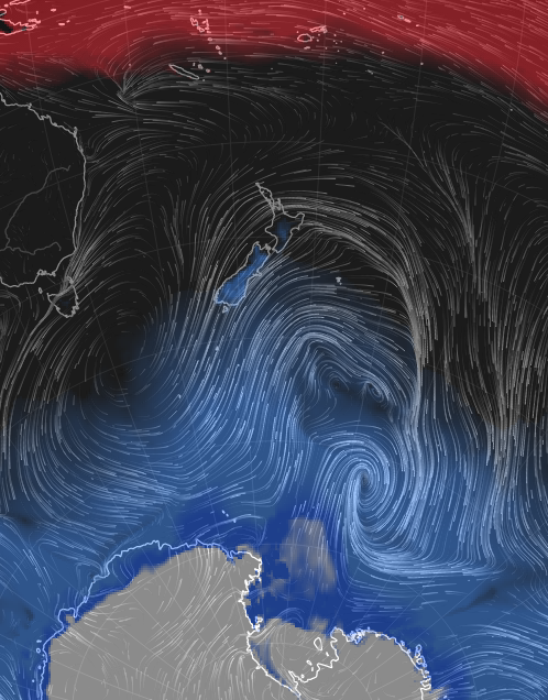 Misery Index shows the coldest air in blue being pushed over the South Island and lower North Island for the most part / earth.nullschool.net
View today’s cold snap in photos – 26 photos can be seen
– WeatherWatch.co.nz
Latest Video

Rain & showers this weekend, colder change next week
Some places will warm up over the next day or so as a nor’wester out of Australia moves across NZ,…
Related Articles
Rain & showers this weekend, colder change next week
Some places will warm up over the next day or so as a nor’wester out of Australia moves across NZ,…

Temperature changes for some regions ahead of heavy West Coast rain
A nor-wester is about to kick in and it’s coming from out of Australia, boosting temperatures in some regions going…

NZ 7 day forecast: Showers, temp changes and heavy West Coast rain
NZ has a fairly messy forecast over the next 7 days, but the main feature will be heavy rain on…

