> From the WeatherWatch archives
Winds over 130km/h blasted parts of coastal Otago last night, while the night before it was Auckland receiving gusts over 100km/h. Windy weather has been off and on across many parts of New Zealand over the past week and half – and more is coming in this week and next week.
However, there’s also a break in the winds as a high briefly moves in for Thursday PM and Friday AM.
While one of New Zealand’s two Government forecasters says the warm weather on Friday/Saturday is coming from Vanuatu, you can quite clearly see the air flow in Vanuatu actually blowing towards Papua New Guinea in the GIF.
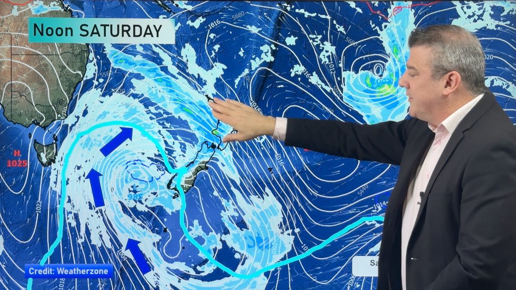
Over Friday and Saturday, a portion of sub-tropical air (mainly from south of New Caledonia) will affect some North Island regions, then a very big Australian airflow kicks in across most of New Zealand over Saturday.
This wind map for Saturday shows a small portion of sub-tropical air, but the bulk of the air flow coming in across New Zealand is coming from Australia.
 Saturday’s wind map shows air coming from Australia, not Vanuatu / Weathermap

– WeatherWatch.co.nz
Comments
Before you add a new comment, take note this story was published on 20 Jul 2016.


Add new comment