A few temperature swings, a subtropical low & subantarctic airflows
8/12/2025 1:51am
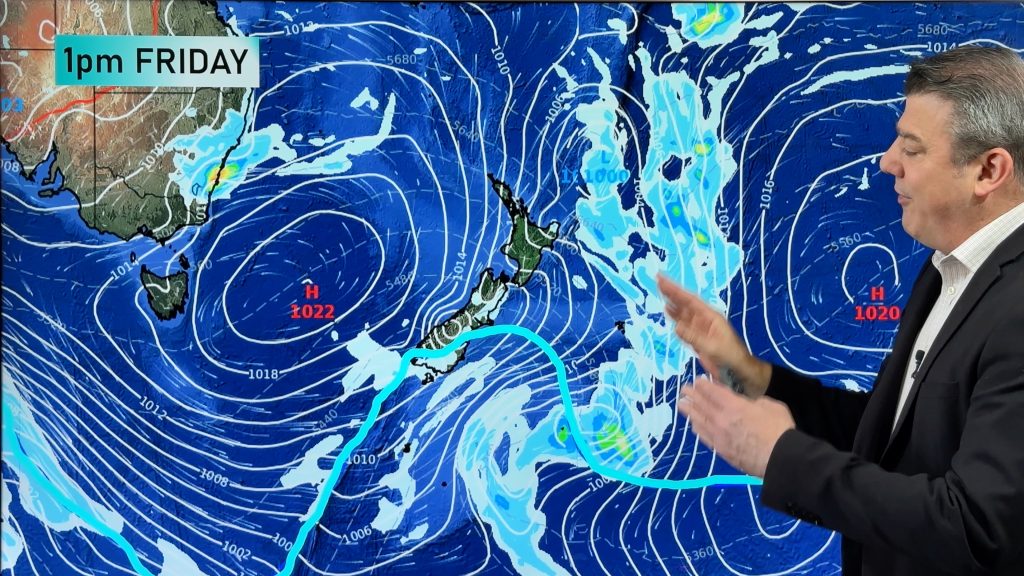
High pressure dominates much of NZ to kick off this week – and likely returns again this weekend – but the process of this will bring temperature fluctuations, especially in the lower South Island where the polar boundary returns later this week.
Many regions lean drier this week, with cooler or more refreshing airflows coming in later in the week.
A subtropical low gets close to NZ, but high pressure should keep it offshore.
High pressure may also weaken the chances of a tropical cyclone forming late this week or weekend around Vanuatu (poses no threat to NZ).
+ A 7 day rainfall map to make sense of any wet weather NZ has this week and weekend.
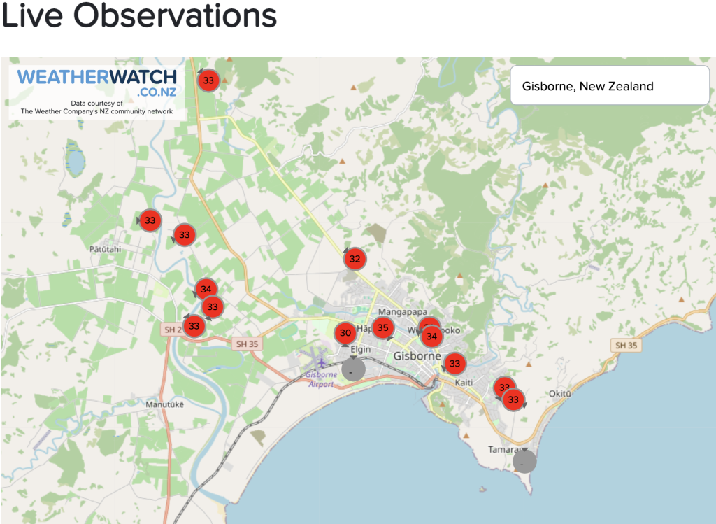
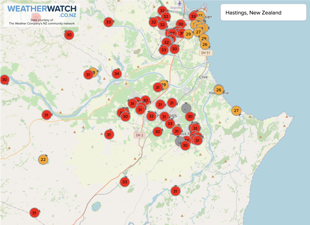
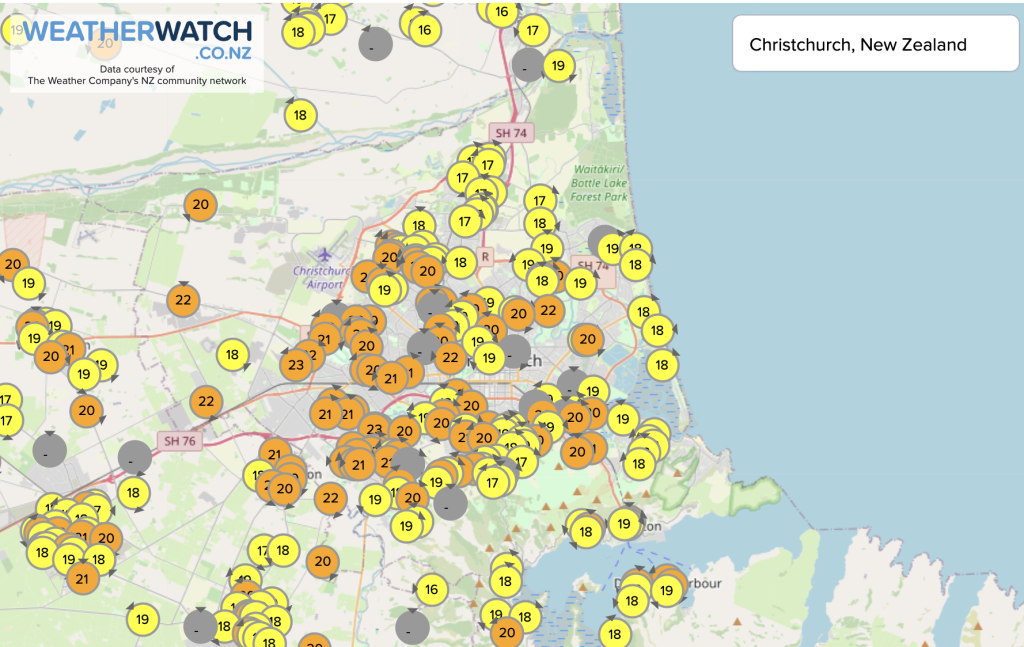
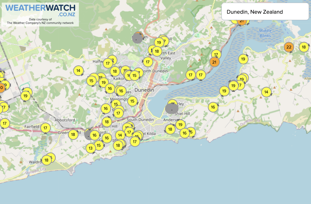
TEMPERATURES AT 2:20pm:
Latest Video

Polar airflows set to bring cold weekend to NZ
Nor-west winds will be building over parts of NZ going into Thursday with rain on the West Coast becoming heavy…
Related Articles

NZ: Cold & windy, then calm & frosty
Downpours, some squally with the chance of thunderstorms and even small tornadoes are possible for parts of NZ over Friday…

WeatherWatch App launches real-time local lightning tracker
A bolt out of the blue! WeatherWatch has launched a live, real-time lightning tracker, enabling Kiwis to gain access to data provided by the…

Wind, rain, showers & a noticeable temperature drop for all
It will be a colder weekend right across NZ as a sub-Antarctic southerly blows through, bringing frosts, snow flurries and…

