
> From the WeatherWatch archives
How much rain and snow is coming to your region over the next five days? We have the latest forecasts and maps as another cold front moves in, another high, then another cold front next week.
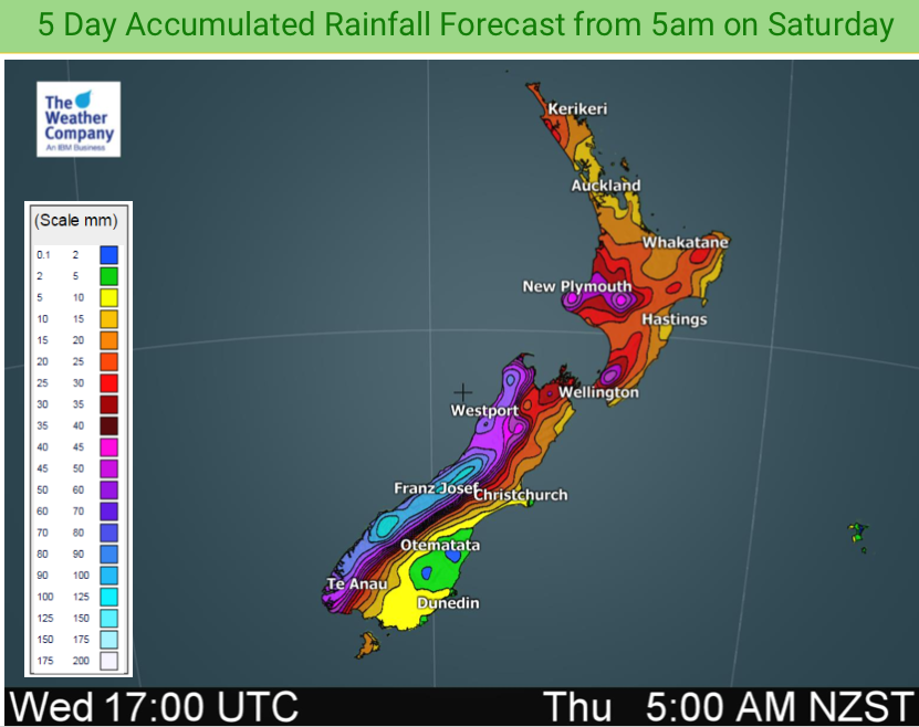
The Southern Alps look as though they’ll get about another metre at higher levels while the North Island’s ski fields finally get some heavier snow coming in thanks to a wintry southerly starting tonight.
Rainfall totals vary, some have over 100mm (West Coast) while others have less than 15mm, like parts of Auckland, Canterbury, Otago and Southland.
RAINFALL NUMBERS FROM 5AM SATURDAY – 2AM MONDAY:

– WeatherWatch.co.nz
Latest Video

Wintry burst of weather: Snow, squally showers then sunshine & frosts
A polar change (another one!) arrives on Friday for the South Island and goes nationwide on Saturday, leaving NZ under…
Related Articles
Wintry burst of weather: Snow, squally showers then sunshine & frosts
A polar change (another one!) arrives on Friday for the South Island and goes nationwide on Saturday, leaving NZ under…

Antarctic southerly for parts of NZ Fri & Sat
For the first time this year a southerly from off Antarctica is heading towards the South Island, followed by more…

Meteors – Your Eyewitness Reports!
WeatherWatch.co.nz receives meteor reports from all over New Zealand and the globe, 24/7/365. **CASUAL COMMENTS**If you’ve seen something in the…

