Weather Video: More lows coming, but we’re also tracking some big highs
25/09/2017 9:52pm

> From the WeatherWatch archives
Yes rain is in the forecast again but what some media outlets are failing to tell you is that we’re also seeing some drying trends kick in and a shift in the big highs over Australia.
The typical spring pattern continues with westerly quarter winds dominating the forecast for the most part Tuesday sees a cold front slowly moving across the North Island.
By Wednesday is will be clearing to the east but a small low is forming on the back end of it and that may keep the showers and southerlies going for the eastern North Island (wont be so hot, like Monday was!).
The South Island sees high pressure for a time on Wednesday which extends briefly into the North Island on Thursday ahead of the next cold front on Friday.
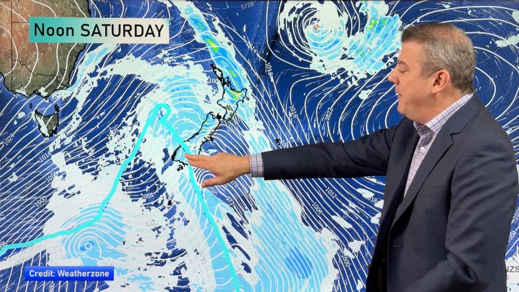
The weekend is similar – with Saturday driest then Sunday potentially wet as another low comes in. Next week we track a gigantic high pressure system over Southern Australia which may drift our way for a time.
Comments
Before you add a new comment, take note this story was published on 25 Sep 2017.


Add new comment