Weather headlines (x3) for Wednesday: Showers in the east, Cold air moves in, Conditions start to clear from Thursday
24/05/2022 7:00pm

> From the WeatherWatch archives
Here’s what is making the weather headlines today.
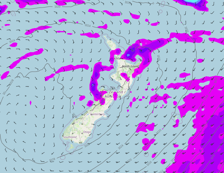
SHOWERS PUSH INTO EASTERN REGIONS
A southerly kink in the airflow pushes showers into eastern regions from mid to late afternoon starting in Canterbury then moving northwards, ending what has been a few very nice days in the east.
Showers won’t hang around for long, they start to clear up for the eastern South Island on Thursday as high pressure moves in, clearing the eastern North Island by Friday.

COLD AIR LEADS TO A FEW SNOW FLURRIES
With the southerly kink in the airflow pushing showers up the eastern side of the country this afternoon / evening, light snow flurries will move in too. Perhaps getting as low as 400m for Southland and Otago, 400m for Canterbury overnight. 700m overnight for the ranges of Marlborough and Wairarapa.
While snow flurries may get to the levels mentioned above they will be relatively light and may not even settle at those levels, any snow accumulations on the ground will likely be higher up.
The maps below show the temperatures at the 850mb level, about 1500m high up in the atmosphere. As we can see at 11am this morning cold air is over the lower South Island, fast forward to midnight and cold air has pushed up the eastern side of the country. This cold air should lead to a few snow flurries to the above mentioned levels.

850mb Temperatures 11am 850mb Temperatures Midnight
CONDITIONS CLEARING UP FROM THURSDAY
As high pressure starts to push in from the Tasman Sea on Thursday the weather will clear up for the lower South Island then the upper South Island into the second half of the day. Expect frosty conditions to start for the lower South Island on Thursday morning especially inland. Frosty conditions spread to the upper South Island overnight.
The North Island will start to see showers clear from afternoon in the west and later in the day in the east. By Friday most of the North Island will be clear and sunny with frosty conditions to start however there will still be showers north of Auckland with northeasterlies.
Thursday 3pm 
Friday 3pm
Latest Video

Some polar airflows but more high pressure to affect NZ’s weather
Showers are in the forecast over the next several days, we track where and when they occur – but there…
Related Articles
Some polar airflows but more high pressure to affect NZ’s weather
Showers are in the forecast over the next several days, we track where and when they occur – but there…

Tracking the showers & colder changes
High pressure isn’t over NZ, but is nearby – and it’s affecting our airflows and who gets wet weather and…

Westerlies continue, sub-tropical for some
West to north-west winds blow through the South Island and lower North Island today bring heavy West Coast rain and…

