Weather Headlines for Wednesday – Settled with eastern cloud then Cyclone Cody
11/01/2022 4:00pm
> From the WeatherWatch archives
Settled then wet for the eastern North Island
Conditions are looking fairly settled till the weekend although we do have a few light showers or drizzle patches to deal with about eastern regions today and on Thursday, later on Thursday and into Friday a few showers may affect Auckland and Northland coming in from the east. Around the 16th or 17th of January what will be Ex Tropical Cyclone Cody moves into the North Island, this has a 60% chance of affecting the North Island in some way now. This could bring heavy rain to eastern regions especially, as is picked up in the rain departure from normal map below.

Temperatures
High’s mostly in the mid to late teens for the South Island today although some inland areas may crack the early twenties, the Nelson and Buller area gets the warmest temperatures in the South Island getting into the early to mid twenties. Temperatures ranging in the mid to late twenties for the North Island, high’s will be warmest about Hawkes Bay, Gisborne and up through to Northland. The eastern North Island cools down on Thursday then warmer weather starts to bounce back for the South Island from Friday.

GFS model data provided by NOAA.
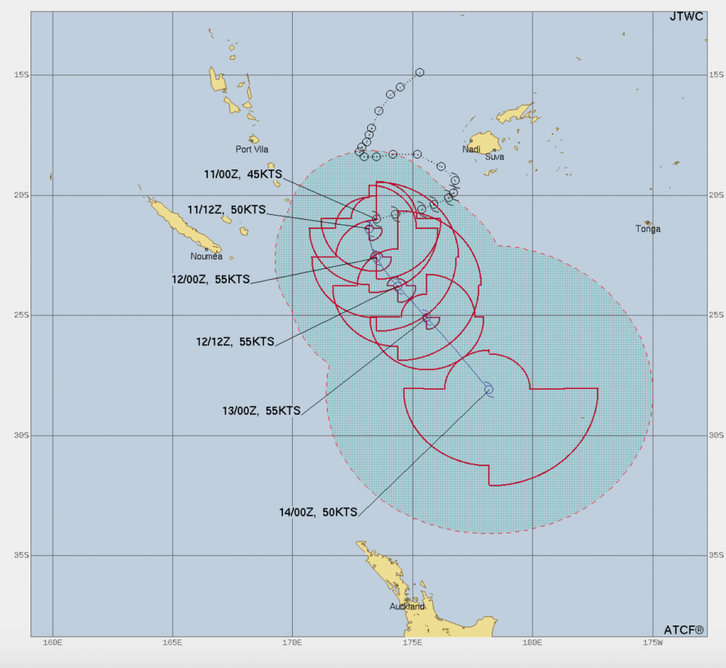
Tropical Cyclone Cody
Tropical Cyclone Cody is now underway to our north. After some deliberating it drops down into New Zealand’s area of responsibility (i.e. MetService takes over from the Fiji Met Office, crosses 25S) this Thursday (tomorrow). The 16th and 17th of January will be the days to watch as this tropical depression may affect the North Island bringing strong winds and heavy rain. The eastern North Island may cop the wettest weather with very heavy rain possible. Please keep up to date with any watches and warnings MetService puts out in regards to this system as we move forward.

Comments
Before you add a new comment, take note this story was published on 11 Jan 2022.
Latest Video

(VIDEO) NZ 7 Day: Variety in the weather, but Southern Ocean storms waking up
Low pressure moves in to NZ from the Tasman Sea this weekend and completely falls apart – bringing downpours and…
Related Articles
(VIDEO) NZ 7 Day: Variety in the weather, but Southern Ocean storms waking up
Low pressure moves in to NZ from the Tasman Sea this weekend and completely falls apart – bringing downpours and…

VIDEO: ClimateWatch: July is the month of BIG lows, BIG highs
This month around New Zealand, Australia and the region we see big highs and big lows – bringing decent stretches…

VIDEO: Severe weather risks for NZ as low moves in
Programming Note: Apologies but we have no video on Thursday – back again on Friday! – A storm in the…


Add new comment