Warmer than normal days and now the nights are about to warm up too (+2 Maps)
24/07/2019 7:58pm

> From the WeatherWatch archives
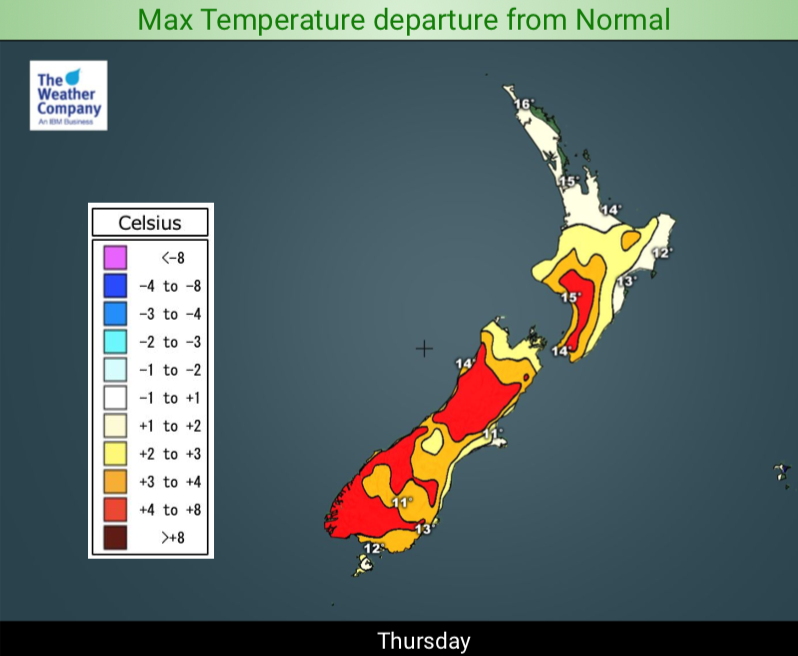
Daytime highs are a few to several degrees above normal for most of NZ and now our nights are about to warm up too.
For the most part NZ has had warmer than average days lately but the nights have been either normal or below normal. But this weekend a sub-tropical airflow kicks in nationwide and that will push up temperatures in what should traditionally be the coldest point of the year.
“Basically from mid July to mid August New Zealand is in the depths of winter temperature-wise. But July is ending on a warm, sub-tropical note and August looks likely to kick off with a weak low bringing more mild airflows in” says head forecaster Philip Duncan.
Mr Duncan says high pressure is likely to dominate again in August but we may see some colder southerlies in the mix too. “We have more heavy snow coming for the Southern Alps but again it’s mostly higher up over then next week”.
August is an unusual month in New Zealand. While it is the peak of winter it can also see signs of early spring. This year an early spring may be even more noticeable due to the mild winter, but August is also well known for surprise snow storms – a killer for lambing and calving. Frosts are also possible – a major headache for vineyards and wine makers. The next several weeks are a very critical time of year for rural New Zealand and WeatherWatch.co.nz will be closely monitoring any sudden polar blasts that may appear.

– WeatherWatch.co.nz
Latest Video

Wintry weather coming: Snow, rain, wind & sunshine
A cold front is moving into NZ from Friday to Sunday with low pressure developing west of NZ and then…
Related Articles

Polar airflow + northern low = pockets of heavy rain & snow
A colder change is coming – and so too is a large low which will develop and grow over northern…
Wintry weather coming: Snow, rain, wind & sunshine
A cold front is moving into NZ from Friday to Sunday with low pressure developing west of NZ and then…

ClimateWatch: JULY outlook & what El Niño means for NZ
El Niño is officially here and still getting stronger in the months ahead, but it’s harder to notice its effects…

