
> From the WeatherWatch archives
NZ is in a westerly flow this week but by the weekend rain shifts to eastern areas thanks to a new low and this spreads rain right across the country.
We have heavy snow on the tops of the Southern Alps and possibly a snow flurry or two down as low as Queenstown and Tekapo today and Wednesday. The daytime highs in Queenstown this week hover between 4 and 6 degrees C, compare that with the Bay of Islands in the north which has highs around 16 or 17 degrees where the westerly flow is dominating.
The westerly is mostly impacting the North Island while localised southerlies affect the lower South Island. But this weekend a low transits the North Island and will push rain into the east – especially the eastern North Island – peaking across this coming Saturday and Sunday.
HISTORICAL RAINFALL (PAST 3 DAYS)
48 HOUR RAINFALL FORECAST: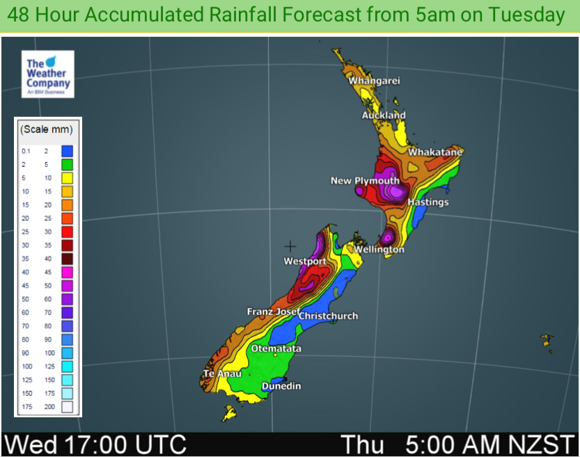
FORECAST RAINFALL – NEXT 5 DAYS:
FORECAST SNOWFALL – NEXT 48 HOURS:
FORECAST SNOWFALL – NEXT 5 DAYS AHEAD:
– WeatherWatch.co.nz
Latest Video

Frosts, late week rain & another cold weekend coming
High pressure will cross NZ over the next few days meaning more cold nights/mornings with frosts, but a nor’wester will…
Related Articles
Frosts, late week rain & another cold weekend coming
High pressure will cross NZ over the next few days meaning more cold nights/mornings with frosts, but a nor’wester will…

NZ: Cold & windy, then calm & frosty
Downpours, some squally with the chance of thunderstorms and even small tornadoes are possible for parts of NZ over Friday…

WeatherWatch App launches real-time local lightning tracker
A bolt out of the blue! WeatherWatch has launched a live, real-time lightning tracker, enabling Kiwis to gain access to data provided by the…

