
> From the WeatherWatch archives
NEW FEATURE: A low is crossing New Zealand and is bringing heavy downpours, isolated thunder and strong winds gusting over gale force at times.
The system is with us for another day or so, before clearing by Tuesday.
In our new official partnership with IBM/The Weather Company we’re proud to bring you the Weather Highlights for Sunday/Monday across New Zealand:
- Strong cold southwesterlies will dominate western coastal parts of the South Island as the low passes through the North Island during Sunday night.
- Gusty winds for the upper North Island with heavy passing downpours.
- Several hours of cold showers will occur in Southland, West Coast, Tasman and Nelson.
- The amount of rain will be moderate and thunderstorms are not likely to occur on the West Coast, but are possible in isolated areas of the upper North Island – but mostly out at sea.
- In the South Island highlands (approximately over 600m), snow or ice may mix in with the rain. In higher mountainous regions some snow accumulation is expected on Sunday night but should not be a concern for most.

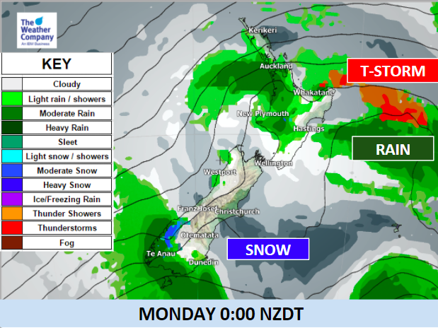
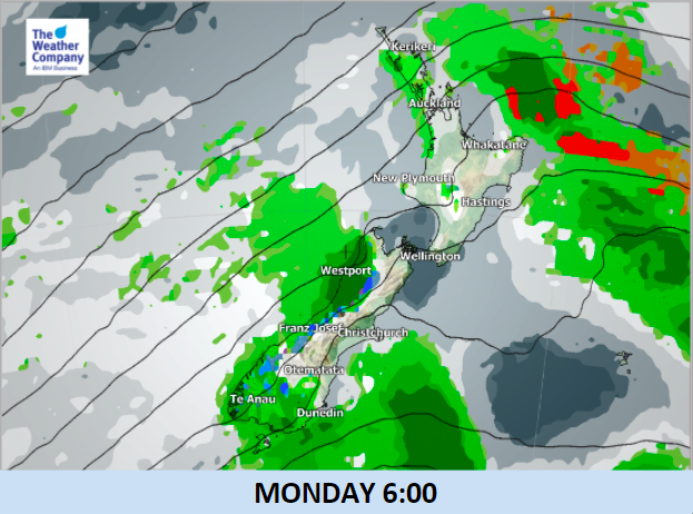
– Images: The Weather Company/IBM
– WeatherWatch.co.nz
Latest Video

Cold weekend, frosts return with high pressure, then a low late next week
The subantarctic airflow spreads over NZ today/tonight and into Saturday, dropping temperatures nationwide. Snow flurries are possible today to lower…
Related Articles
Cold weekend, frosts return with high pressure, then a low late next week
The subantarctic airflow spreads over NZ today/tonight and into Saturday, dropping temperatures nationwide. Snow flurries are possible today to lower…

Wintry burst of weather: Snow, squally showers then sunshine & frosts
A polar change (another one!) arrives on Friday for the South Island and goes nationwide on Saturday, leaving NZ under…

Antarctic southerly for parts of NZ Fri & Sat
For the first time this year a southerly from off Antarctica is heading towards the South Island, followed by more…

