Tuesday’s weather headlines (x3): Warming up inland, Front later in the south, Warm in the east on Friday
14/02/2022 6:00pm
> From the WeatherWatch archives
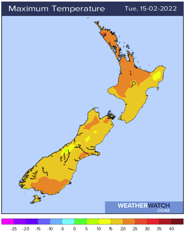
STARTING TO WARM UP INLAND
Conditions are settled around New Zealand today thanks to a high pressure system. While there is still some residual cool air from the southwesterly airflow we have just had, inland areas are bouncing back with afternoon highs getting into the mid to late twenties for inland South Island spots. Inland Bay Of Plenty, Waikato and inner Northland sees highs getting into the mid twenties.
FRONT MOVES ONTO THE LOWER SOUTH ISLAND LATER TODAY
A cold front moves onto the lower South Island later this evening / overnight bringing showers to Southland then Otago. The front moves further north on Wednesday but there is only the risk of a shower Canterbury northwards in the east.

WARM IN THE EAST ON FRIDAY
A northerly airflow lies over New Zealand on Friday with warm temperatures likely for eastern regions getting up into the late twenties, possibly at a push some spots may even reach thirty.
Latest Video

NZ 7 day forecast: Showers, temp changes and heavy West Coast rain
NZ has a fairly messy forecast over the next 7 days, but the main feature will be heavy rain on…
Related Articles
NZ 7 day forecast: Showers, temp changes and heavy West Coast rain
NZ has a fairly messy forecast over the next 7 days, but the main feature will be heavy rain on…

Cold fronts continue, wind & rain for some Fri/Sat
Wet weather is moving over the North Island today, while the South Island has drier skies – ahead of another…

Cold fronts vs high pressure
A cold front is moving up NZ today and into Tuesday, but will fall apart as it heads north and…

