Tuesday’s weather headlines (x3): Heavy showers in the north, Warm in the east tomorrow, Unsettled Thursday
18/04/2022 7:00pm
> From the WeatherWatch archives
Here’s what is making the weather headlines today.
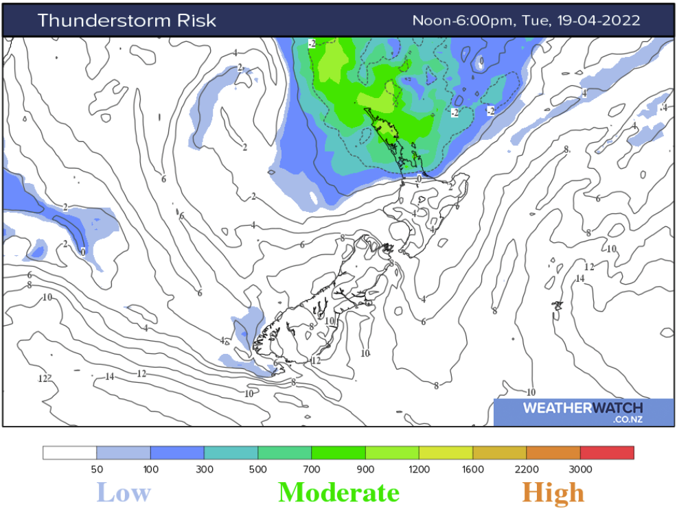
HEAVY SHOWERS IN THE NORTH
There may be some instability in the far north today which could result in isolated heavy showers, perhaps even a few rumbles of thunder. This is mainly north of Auckland in an east to northeasterly airflow. This instability is mainly the result of very warm moist air at the surface.
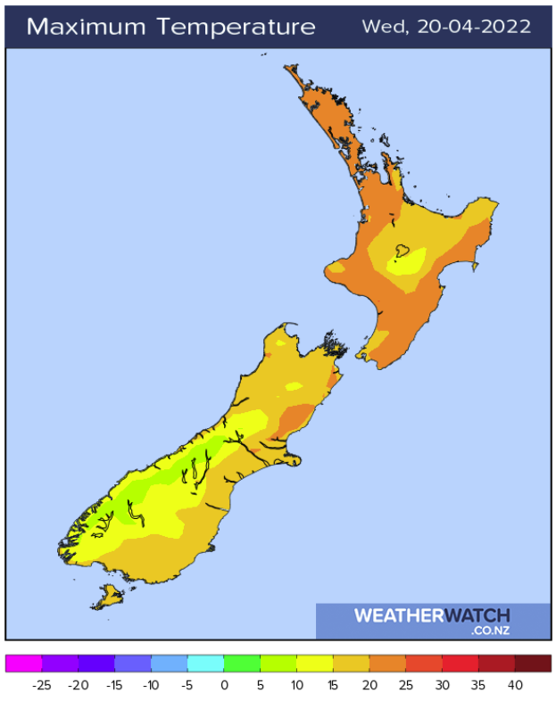
TEMPERATURES – MID TWENTIES FOR EASTERN REGIONS TOMORROW
A northerly quarter airflow brings warm temperatures to eastern regions tomorrow, high’s reaching up to 24 to 25 degrees Canterbury northwards up through to Hawkes Bay / Gisborne. Auckland and Northland may reach as high as 24 degrees also.
UNSETTLED WEATHER MOVES IN ON THURSDAY
Frontal systems move in on Thursday bringing heavy rain to the West Coast, rain becomes heavy later in the day for the North Island also mainly in the west. Expect rain for Southland, gradually moving into Otago as a cold front moves northwards then overnight rain develops about Canterbury.

Comments
Before you add a new comment, take note this story was published on 18 Apr 2022.
Latest Video

VIDEO: ClimateWatch: July is the month of BIG lows, BIG highs
This month around New Zealand, Australia and the region we see big highs and big lows – bringing decent stretches…
Related Articles
VIDEO: ClimateWatch: July is the month of BIG lows, BIG highs
This month around New Zealand, Australia and the region we see big highs and big lows – bringing decent stretches…

VIDEO: Severe weather risks for NZ as low moves in
Programming Note: Apologies but we have no video on Thursday – back again on Friday! – A storm in the…

VIDEO (NZ): Large low looms – who gets rain/wind & who does not
Another large low will bring severe weather to parts of both main islands of NZ this week, followed by a…


Add new comment