
> From the WeatherWatch archives
Dry weather is dominating across New Zealand at the moment – and while it’s very welcome in the northern and eastern North Island in particular, it’s not going to remain dry.
Across Friday rain clouds will move up the West Coast with heavy falls and the odd thunderstorm.
As this front tracks northwards up the South Island today it will run into higher air pressure over the North Island.
The further north the front goes, the more it weakens.
So overnight tonight this front will start to push into the North Island with showers and patchy rain.
The cold front disintegrates over the North Island on Saturday thanks to higher air pressure in the north and the general lack of energy with this front. This means rain clouds break up into showers and there are larger areas with dry weather.
By Saturday evening most places in New Zealand will be dry again, or becoming dry – with Sunday looking dry for most places with the exception, again, of the West Coast as the next cold front moves in.
12 Noon Friday
Midnight Friday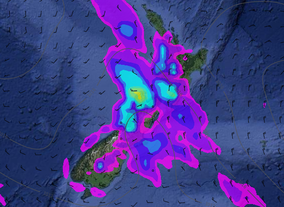
12 Noon Saturday
Midnight Saturday
– Images / Weathermap.co.nz
– WeatherWatch.co.nz
Comments
Before you add a new comment, take note this story was published on 12 Aug 2016.
Latest Video

VIDEO: Another big low late week brings severe weather risks to NZ
Severe weather is back in the forecast later this week after we kick off July with high pressure at the…
Related Articles
VIDEO: Another big low late week brings severe weather risks to NZ
Severe weather is back in the forecast later this week after we kick off July with high pressure at the…

VIDEO: NZ 7 Day: One big low, a high, then another big low
Severe weather risks continue around NZ’s two main islands for the rest of Friday and going into Saturday, before conditions…

VIDEO: Severe weather for parts of NZ, ahead of more high pressure
A large low in the Tasman Sea will bring further heavy rain and strong winds to western and southern parts…


Add new comment