
> From the WeatherWatch archives
A south to southwesterly airflow lies over New Zealand today, moving around a large high pressure system centred in the Tasman Sea.
Northland, Auckland, Waikato & Bay Of Plenty
A mix of sun and cloud with the chance of a shower otherwise mainly dry, southwesterly winds tend southerly in the evening. The Waikato and Bay Of Plenty is sunny from morning with light winds.
Highs: 19-20
Western North Island (including Central North Island)
Sunny spells with south to southeasterly winds. Morning cloud about Taranaki clears to mainly sunny weather.
Highs: 15-18
Eastern North Island
Cloudy areas and the odd shower, especially coastal while remaining drier the further inland one goes. Fresh southwesterly winds.
Highs: 15-17
Wellington
Chance of a shower or two during today, mostly cloudy with fresh cool southerly winds.
High: 14
Marlborough & Nelson
Morning cloud breaks to mostly sunny weather, southeasterly winds die out later in the evening. Light northerlies in the afternoon for Nelson.
Highs: 15-16
Canterbury
Morning cloud with the chance of a shower, afternoon sunny spells. Southwesterly winds, fresh about the coast die out later on.
Highs: 13-15
West Coast
Mainly sunny with light winds.
Highs: 16-18
Southland & Otago
Any early showers clear then cloud breaks to sunny spells in the afternoon, west to southwesterly winds die out in the evening.
Highs: 13-14
By Weather Analyst Aaron Wilkinson – WeatherWatch.co.nz
Latest Video
28/05/2026 12:31am
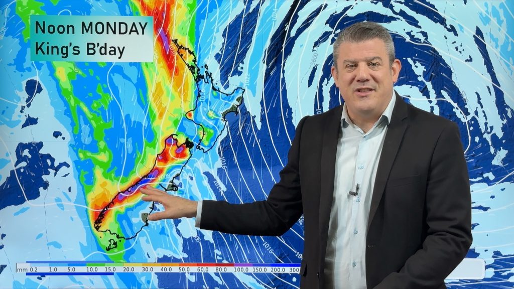
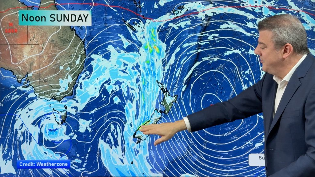
Heavy rain & gusty winds for parts of NZ this long weekend
The long weekend starts off mostly settled and dry, then subtropical north to north-west winds kick in with heavy West…
Related Articles
28/05/2026 12:31am
Heavy rain & gusty winds for parts of NZ this long weekend
The long weekend starts off mostly settled and dry, then subtropical north to north-west winds kick in with heavy West…
26/05/2026 11:44pm
Latest on the long weekend weather
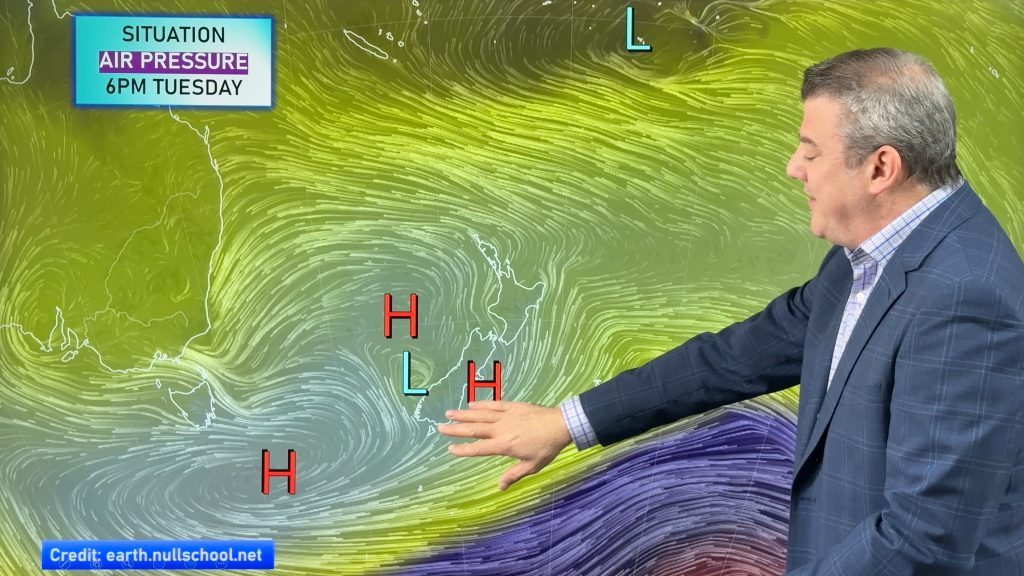
We still have another large high pressure zone to move over the nation, but subtropical northerlies will pick up this…
26/05/2026 12:12am
Subtropical northerlies and some wet weather chances going into the long weekend
More high pressure is moving over NZ this week but this week it slides east of us, creating subtropical northerlies…

