Thursday’s a scorcher for some, while others see a double digit temperature drop
12/02/2019 10:28pm

> From the WeatherWatch archives
We have a surge of hotter weather on Thursday ahead of a cooler change sweeping in later for some further south. Daytime highs in some parts of the lower South Island will drop 8 to 12 degrees on Thursday from where you are today.
Before that happens it will be very hot around the upper South Island and eastern North Island with highs up to 33 degrees inland and late 20s in coastal parts on Thursday afternoon. The southern cool change arrives in Canterbury by Friday and places like Christchurch may see a several to 10 degree drop in daytime highs from Thursday.
The cooler change fades out around the lower North Island/Cook Strait area on Friday.
Most other places are warmer than average this week.
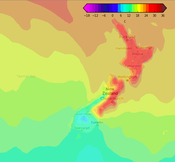
4pm Temperature map for Thursday shows the cold front moving up the lower South Island (Weathermap.co.nz)
– WeatherWatch.co.nz
Latest Video

NZ: 8 Day outlook as gales & rain ease, high pressure builds
Damaging wind gusts and heavy rain will continue to affect some parts of the North Island and brushing Marlborough today…
Related Articles
NZ: 8 Day outlook as gales & rain ease, high pressure builds
Damaging wind gusts and heavy rain will continue to affect some parts of the North Island and brushing Marlborough today…

Pockets of hit & miss heavy rain, snow moves northwards
Low pressure continues to slowly move across the upper North Island and for some that will bring the sun out,…

Slow go for northern low & southern cold
For the next few days low pressure will crawl over the upper North Island, driving in rain as far south…

